You are here: Home > Network List > WY - Yellowstone Wyoming Seismic Network Stations List
> Station YHH Holmes Hill, YNP, WY, USA > Earthquake Result Viewer
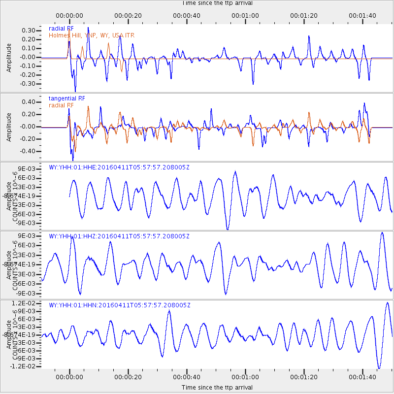
YHH Holmes Hill, YNP, WY, USA - Earthquake Result Viewer
*The percent match for this event was below the threshold and hence no stack was calculated.
| Earthquake location: |
Taiwan Region |
| Earthquake latitude/longitude: |
24.6/122.1 |
| Earthquake time(UTC): |
2016/04/11 (102) 05:45:08 GMT |
| Earthquake Depth: |
58 km |
| Earthquake Magnitude: |
4.8 Mwr |
| Earthquake Catalog/Contributor: |
NEIC PDE/us |
|
| Network: |
WY Yellowstone Wyoming Seismic Network |
| Station: |
YHH Holmes Hill, YNP, WY, USA |
| Lat/Lon: |
44.79 N/110.85 W |
| Elevation: |
2717 m |
|
| Distance: |
95.7 deg |
| Az: |
34.855 deg |
| Baz: |
313.044 deg |
| Ray Param: |
$rayparam |
*The percent match for this event was below the threshold and hence was not used in the summary stack. |
|
| Radial Match: |
51.48136 % |
| Radial Bump: |
348 |
| Transverse Match: |
48.313812 % |
| Transverse Bump: |
400 |
| SOD ConfigId: |
7422571 |
| Insert Time: |
2019-04-22 05:02:21.593 +0000 |
| GWidth: |
2.5 |
| Max Bumps: |
400 |
| Tol: |
0.001 |
|
Signal To Noise
| Channel | StoN | STA | LTA |
| WY:YHH:01:HHZ:20160411T05:57:57.208005Z | 2.6890597 | 5.8970575E-9 | 2.1929814E-9 |
| WY:YHH:01:HHN:20160411T05:57:57.208005Z | 1.1562656 | 2.6789513E-9 | 2.3168996E-9 |
| WY:YHH:01:HHE:20160411T05:57:57.208005Z | 0.81965953 | 2.970343E-9 | 3.6238743E-9 |
| Arrivals |
| Ps | |
| PpPs | |
| PsPs/PpSs | |


