
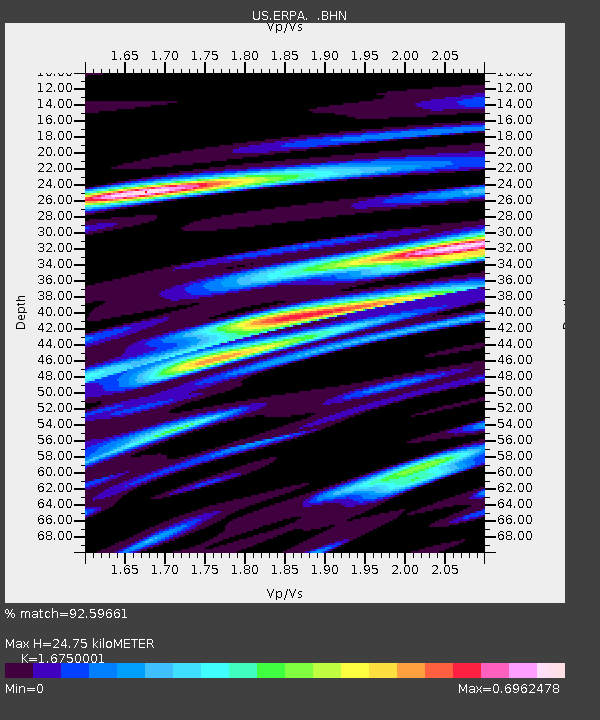
ERPA Erie, Pennsylvania, USA - Earthquake Result Viewer
| ||||||||||||||||||
| ||||||||||||||||||
| ||||||||||||||||||
|
Signal To Noise
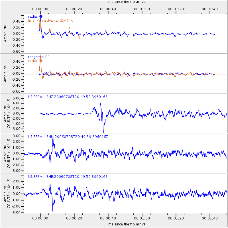
| Channel | StoN | STA | LTA |
| US:ERPA: :BHN:20060708T20:49:59.396016Z | 2.900672 | 3.3715227E-7 | 1.1623247E-7 |
| US:ERPA: :BHE:20060708T20:49:59.396016Z | 3.837892 | 5.156726E-7 | 1.3436349E-7 |
| US:ERPA: :BHZ:20060708T20:49:59.396016Z | 7.069364 | 1.2512011E-6 | 1.769892E-7 |
| Arrivals | |
| Ps | 2.7 SECOND |
| PpPs | 9.9 SECOND |
| PsPs/PpSs | 13 SECOND |

