ERPA Erie, Pennsylvania, USA - Earthquake Result Viewer
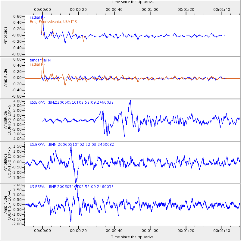
Earthquake location: Fox Islands, Aleutian Islands
Earthquake latitude/longitude: 52.5/-169.3
Earthquake time(UTC): 2006/05/10 (130) 02:42:51 GMT
Earthquake Depth: 18 km
Earthquake Magnitude: 6.1 MB, 6.2 MS, 6.4 MW, 6.3 MW
Earthquake Catalog/Contributor: WHDF/NEIC
Network: US United States National Seismic Network
Station: ERPA Erie, Pennsylvania, USA
Lat/Lon: 42.12 N/79.99 W
Elevation: 306 m
Distance: 57.7 deg
Az: 61.686 deg
Baz: 313.686 deg
Ray Param: 0.063320555
Estimated Moho Depth: 32.25 km
Estimated Crust Vp/Vs: 2.02
Assumed Crust Vp: 6.419 km/s
Estimated Crust Vs: 3.178 km/s
Estimated Crust Poisson's Ratio: 0.34
Radial Match: 93.35169 %
Radial Bump: 321
Transverse Match: 65.49732 %
Transverse Bump: 400
SOD ConfigId: 2669
Insert Time: 2010-03-05 01:12:15.123 +0000
GWidth: 2.5
Max Bumps: 400
Tol: 0.001

Signal To Noise

ChannelStoNSTALTA
US:ERPA: :BHN:20060510T02:52:09.246003Z2.60503983.9505528E-71.5165037E-7
US:ERPA: :BHE:20060510T02:52:09.246003Z2.89564734.9394225E-71.7058095E-7
US:ERPA: :BHZ:20060510T02:52:09.246003Z6.26158951.2600809E-62.0123979E-7
Arrivals
Ps5.4 SECOND
PpPs15 SECOND
PsPs/PpSs20 SECOND