You are here: Home > Network List > US - United States National Seismic Network Stations List
> Station ERPA Erie, Pennsylvania, USA > Earthquake Result Viewer
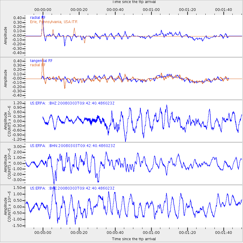
ERPA Erie, Pennsylvania, USA - Earthquake Result Viewer
*The percent match for this event was below the threshold and hence no stack was calculated.
| Earthquake location: |
Kuril Islands |
| Earthquake latitude/longitude: |
46.4/153.2 |
| Earthquake time(UTC): |
2008/03/03 (063) 09:31:02 GMT |
| Earthquake Depth: |
10 km |
| Earthquake Magnitude: |
6.2 MB, 6.5 MS, 6.5 MW, 6.5 MW |
| Earthquake Catalog/Contributor: |
WHDF/NEIC |
|
| Network: |
US United States National Seismic Network |
| Station: |
ERPA Erie, Pennsylvania, USA |
| Lat/Lon: |
42.12 N/79.99 W |
| Elevation: |
306 m |
|
| Distance: |
80.0 deg |
| Az: |
37.205 deg |
| Baz: |
325.78 deg |
| Ray Param: |
$rayparam |
*The percent match for this event was below the threshold and hence was not used in the summary stack. |
|
| Radial Match: |
72.682495 % |
| Radial Bump: |
400 |
| Transverse Match: |
54.716564 % |
| Transverse Bump: |
400 |
| SOD ConfigId: |
2504 |
| Insert Time: |
2010-03-05 01:12:50.828 +0000 |
| GWidth: |
2.5 |
| Max Bumps: |
400 |
| Tol: |
0.001 |
|
Signal To Noise
| Channel | StoN | STA | LTA |
| US:ERPA: :BHN:20080303T09:42:40.486023Z | 2.9263268 | 7.5073524E-7 | 2.5654526E-7 |
| US:ERPA: :BHE:20080303T09:42:40.486023Z | 1.5601735 | 3.8565386E-7 | 2.4718653E-7 |
| US:ERPA: :BHZ:20080303T09:42:40.486023Z | 0.8874108 | 1.6644073E-7 | 1.8755769E-7 |
| Arrivals |
| Ps | |
| PpPs | |
| PsPs/PpSs | |


