You are here: Home > Network List > US - United States National Seismic Network Stations List
> Station MSO Missoula, Montana, USA > Earthquake Result Viewer
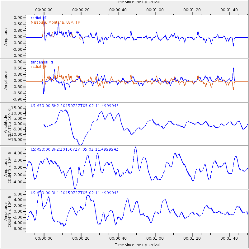
MSO Missoula, Montana, USA - Earthquake Result Viewer
*The percent match for this event was below the threshold and hence no stack was calculated.
| Earthquake location: |
Fox Islands, Aleutian Islands |
| Earthquake latitude/longitude: |
52.2/-169.5 |
| Earthquake time(UTC): |
2015/07/27 (208) 04:55:45 GMT |
| Earthquake Depth: |
21 km |
| Earthquake Magnitude: |
6.7 MS |
| Earthquake Catalog/Contributor: |
NEIC PDE/NEIC ALERT |
|
| Network: |
US United States National Seismic Network |
| Station: |
MSO Missoula, Montana, USA |
| Lat/Lon: |
46.83 N/113.94 W |
| Elevation: |
1264 m |
|
| Distance: |
35.7 deg |
| Az: |
75.906 deg |
| Baz: |
299.504 deg |
| Ray Param: |
$rayparam |
*The percent match for this event was below the threshold and hence was not used in the summary stack. |
|
| Radial Match: |
20.209352 % |
| Radial Bump: |
301 |
| Transverse Match: |
21.41284 % |
| Transverse Bump: |
253 |
| SOD ConfigId: |
1085051 |
| Insert Time: |
2015-08-10 05:31:58.126 +0000 |
| GWidth: |
2.5 |
| Max Bumps: |
400 |
| Tol: |
0.001 |
|
Signal To Noise
| Channel | StoN | STA | LTA |
| US:MSO:00:BHZ:20150727T05:02:11.499994Z | 1.4309585 | 2.2623894E-6 | 1.5810308E-6 |
| US:MSO:00:BH1:20150727T05:02:11.499994Z | 1.1430649 | 3.3131707E-6 | 2.8984975E-6 |
| US:MSO:00:BH2:20150727T05:02:11.499994Z | 1.0795553 | 1.119134E-5 | 1.0366621E-5 |
| Arrivals |
| Ps | |
| PpPs | |
| PsPs/PpSs | |


