You are here: Home > Network List > US - United States National Seismic Network Stations List
> Station ERPA Erie, Pennsylvania, USA > Earthquake Result Viewer
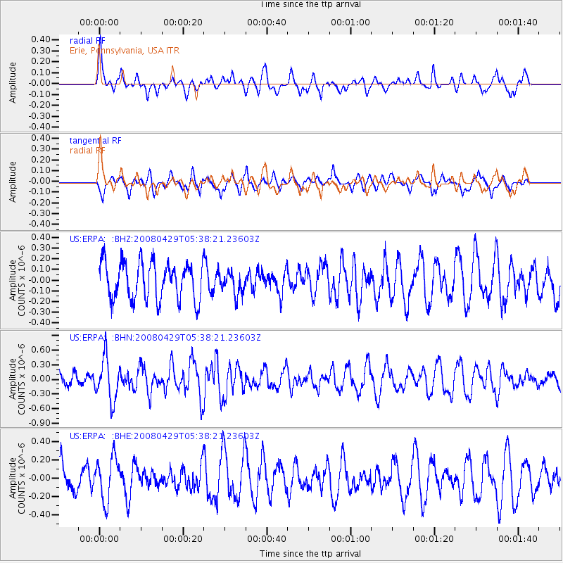
ERPA Erie, Pennsylvania, USA - Earthquake Result Viewer
*The percent match for this event was below the threshold and hence no stack was calculated.
| Earthquake location: |
Hokkaido, Japan Region |
| Earthquake latitude/longitude: |
41.5/142.0 |
| Earthquake time(UTC): |
2008/04/29 (120) 05:26:04 GMT |
| Earthquake Depth: |
47 km |
| Earthquake Magnitude: |
5.5 MB, 5.2 MS, 5.8 MW, 5.8 MW |
| Earthquake Catalog/Contributor: |
WHDF/NEIC |
|
| Network: |
US United States National Seismic Network |
| Station: |
ERPA Erie, Pennsylvania, USA |
| Lat/Lon: |
42.12 N/79.99 W |
| Elevation: |
306 m |
|
| Distance: |
88.6 deg |
| Az: |
29.88 deg |
| Baz: |
329.779 deg |
| Ray Param: |
$rayparam |
*The percent match for this event was below the threshold and hence was not used in the summary stack. |
|
| Radial Match: |
61.61548 % |
| Radial Bump: |
400 |
| Transverse Match: |
55.624817 % |
| Transverse Bump: |
400 |
| SOD ConfigId: |
2504 |
| Insert Time: |
2010-03-05 01:12:56.653 +0000 |
| GWidth: |
2.5 |
| Max Bumps: |
400 |
| Tol: |
0.001 |
|
Signal To Noise
| Channel | StoN | STA | LTA |
| US:ERPA: :BHN:20080429T05:38:21.23603Z | 2.4409614 | 4.36281E-7 | 1.7873327E-7 |
| US:ERPA: :BHE:20080429T05:38:21.23603Z | 1.121647 | 2.434306E-7 | 2.1702961E-7 |
| US:ERPA: :BHZ:20080429T05:38:21.23603Z | 0.5818916 | 1.0244812E-7 | 1.760605E-7 |
| Arrivals |
| Ps | |
| PpPs | |
| PsPs/PpSs | |


