You are here: Home > Network List > US - United States National Seismic Network Stations List
> Station ERPA Erie, Pennsylvania, USA > Earthquake Result Viewer
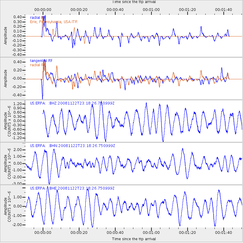
ERPA Erie, Pennsylvania, USA - Earthquake Result Viewer
*The percent match for this event was below the threshold and hence no stack was calculated.
| Earthquake location: |
Southeast Of Easter Island |
| Earthquake latitude/longitude: |
-37.2/-95.1 |
| Earthquake time(UTC): |
2008/11/22 (327) 23:06:47 GMT |
| Earthquake Depth: |
10 km |
| Earthquake Magnitude: |
5.6 MB, 5.3 MS, 5.7 MW, 5.7 MW |
| Earthquake Catalog/Contributor: |
WHDF/NEIC |
|
| Network: |
US United States National Seismic Network |
| Station: |
ERPA Erie, Pennsylvania, USA |
| Lat/Lon: |
42.12 N/79.99 W |
| Elevation: |
306 m |
|
| Distance: |
80.2 deg |
| Az: |
11.326 deg |
| Baz: |
192.161 deg |
| Ray Param: |
$rayparam |
*The percent match for this event was below the threshold and hence was not used in the summary stack. |
|
| Radial Match: |
74.76243 % |
| Radial Bump: |
400 |
| Transverse Match: |
61.800694 % |
| Transverse Bump: |
400 |
| SOD ConfigId: |
2658 |
| Insert Time: |
2010-03-05 01:13:13.199 +0000 |
| GWidth: |
2.5 |
| Max Bumps: |
400 |
| Tol: |
0.001 |
|
Signal To Noise
| Channel | StoN | STA | LTA |
| US:ERPA: :BHN:20081122T23:18:26.750999Z | 2.3575463 | 1.6514182E-6 | 7.0048173E-7 |
| US:ERPA: :BHE:20081122T23:18:26.750999Z | 2.5727239 | 1.2938083E-6 | 5.0289435E-7 |
| US:ERPA: :BHZ:20081122T23:18:26.750999Z | 1.9088123 | 9.682889E-7 | 5.0727294E-7 |
| Arrivals |
| Ps | |
| PpPs | |
| PsPs/PpSs | |


