You are here: Home > Network List > US - United States National Seismic Network Stations List
> Station ERPA Erie, Pennsylvania, USA > Earthquake Result Viewer
ERPA Erie, Pennsylvania, USA - Earthquake Result Viewer
*The percent match for this event was below the threshold and hence no stack was calculated.
| Earthquake location: |
Peru-Bolivia Border Region |
| Earthquake latitude/longitude: |
-15.6/-69.3 |
| Earthquake time(UTC): |
2009/09/30 (273) 19:03:17 GMT |
| Earthquake Depth: |
255 km |
| Earthquake Magnitude: |
5.9 MB, 5.8 MW |
| Earthquake Catalog/Contributor: |
WHDF/NEIC |
|
| Network: |
US United States National Seismic Network |
| Station: |
ERPA Erie, Pennsylvania, USA |
| Lat/Lon: |
42.12 N/79.99 W |
| Elevation: |
306 m |
|
| Distance: |
58.2 deg |
| Az: |
350.652 deg |
| Baz: |
167.852 deg |
| Ray Param: |
$rayparam |
*The percent match for this event was below the threshold and hence was not used in the summary stack. |
|
| Radial Match: |
58.779625 % |
| Radial Bump: |
400 |
| Transverse Match: |
52.32055 % |
| Transverse Bump: |
400 |
| SOD ConfigId: |
2622 |
| Insert Time: |
2010-03-05 01:13:16.684 +0000 |
| GWidth: |
2.5 |
| Max Bumps: |
400 |
| Tol: |
0.001 |
|
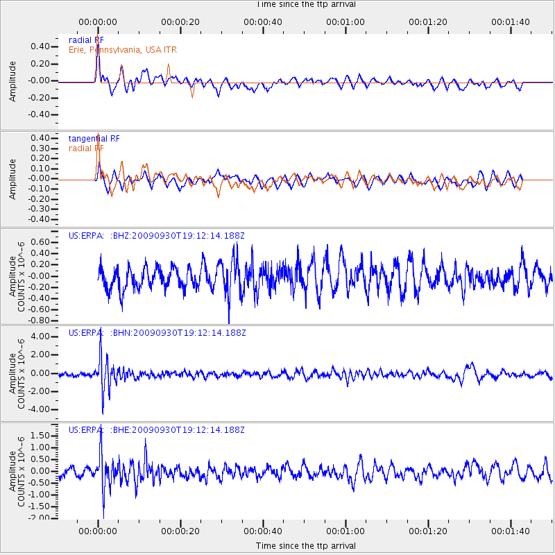
Signal To Noise
| Channel | StoN | STA | LTA |
| US:ERPA: :BHN:20090930T19:12:14.188Z | 8.731399 | 1.7676329E-6 | 2.0244555E-7 |
| US:ERPA: :BHE:20090930T19:12:14.188Z | 4.140683 | 7.158145E-7 | 1.7287351E-7 |
| US:ERPA: :BHZ:20090930T19:12:14.188Z | 1.7527064 | 3.1870132E-7 | 1.8183383E-7 |
| Arrivals |
| Ps | |
| PpPs | |
| PsPs/PpSs | |


