You are here: Home > Network List > US - United States National Seismic Network Stations List
> Station ERPA Erie, Pennsylvania, USA > Earthquake Result Viewer
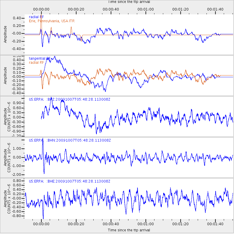
ERPA Erie, Pennsylvania, USA - Earthquake Result Viewer
*The percent match for this event was below the threshold and hence no stack was calculated.
| Earthquake location: |
Rat Islands, Aleutian Islands |
| Earthquake latitude/longitude: |
52.2/178.1 |
| Earthquake time(UTC): |
2009/10/07 (280) 05:38:37 GMT |
| Earthquake Depth: |
138 km |
| Earthquake Magnitude: |
5.6 MB, 5.6 MW, 5.6 MW |
| Earthquake Catalog/Contributor: |
WHDF/NEIC |
|
| Network: |
US United States National Seismic Network |
| Station: |
ERPA Erie, Pennsylvania, USA |
| Lat/Lon: |
42.12 N/79.99 W |
| Elevation: |
306 m |
|
| Distance: |
64.4 deg |
| Az: |
53.781 deg |
| Baz: |
318.084 deg |
| Ray Param: |
$rayparam |
*The percent match for this event was below the threshold and hence was not used in the summary stack. |
|
| Radial Match: |
42.10495 % |
| Radial Bump: |
400 |
| Transverse Match: |
23.839405 % |
| Transverse Bump: |
400 |
| SOD ConfigId: |
2622 |
| Insert Time: |
2010-03-05 01:13:18.158 +0000 |
| GWidth: |
2.5 |
| Max Bumps: |
400 |
| Tol: |
0.001 |
|
Signal To Noise
| Channel | StoN | STA | LTA |
| US:ERPA: :BHN:20091007T05:48:28.113008Z | 2.650589 | 8.1267916E-7 | 3.0660323E-7 |
| US:ERPA: :BHE:20091007T05:48:28.113008Z | 1.0673816 | 4.2685758E-7 | 3.9991096E-7 |
| US:ERPA: :BHZ:20091007T05:48:28.113008Z | 2.7677524 | 1.0230708E-6 | 3.696396E-7 |
| Arrivals |
| Ps | |
| PpPs | |
| PsPs/PpSs | |


