You are here: Home > Network List > US - United States National Seismic Network Stations List
> Station ERPA Erie, Pennsylvania, USA > Earthquake Result Viewer
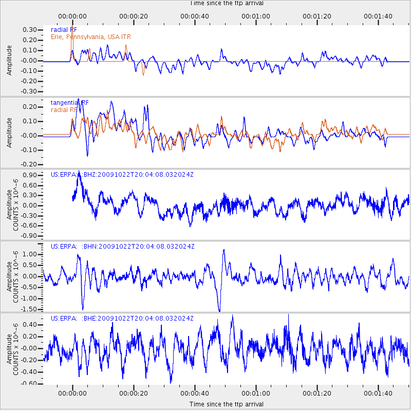
ERPA Erie, Pennsylvania, USA - Earthquake Result Viewer
*The percent match for this event was below the threshold and hence no stack was calculated.
| Earthquake location: |
Hindu Kush Region, Afghanistan |
| Earthquake latitude/longitude: |
36.5/70.9 |
| Earthquake time(UTC): |
2009/10/22 (295) 19:51:27 GMT |
| Earthquake Depth: |
186 km |
| Earthquake Magnitude: |
6.1 MB, 6.2 MW, 6.1 MW |
| Earthquake Catalog/Contributor: |
WHDF/NEIC |
|
| Network: |
US United States National Seismic Network |
| Station: |
ERPA Erie, Pennsylvania, USA |
| Lat/Lon: |
42.12 N/79.99 W |
| Elevation: |
306 m |
|
| Distance: |
97.4 deg |
| Az: |
338.63 deg |
| Baz: |
23.238 deg |
| Ray Param: |
$rayparam |
*The percent match for this event was below the threshold and hence was not used in the summary stack. |
|
| Radial Match: |
38.650436 % |
| Radial Bump: |
400 |
| Transverse Match: |
52.806644 % |
| Transverse Bump: |
400 |
| SOD ConfigId: |
2622 |
| Insert Time: |
2010-03-05 01:13:20.970 +0000 |
| GWidth: |
2.5 |
| Max Bumps: |
400 |
| Tol: |
0.001 |
|
Signal To Noise
| Channel | StoN | STA | LTA |
| US:ERPA: :BHN:20091022T20:04:08.032024Z | 2.0948386 | 6.564119E-7 | 3.1334724E-7 |
| US:ERPA: :BHE:20091022T20:04:08.032024Z | 1.242725 | 1.979636E-7 | 1.59298E-7 |
| US:ERPA: :BHZ:20091022T20:04:08.032024Z | 1.4130312 | 3.8671106E-7 | 2.7367483E-7 |
| Arrivals |
| Ps | |
| PpPs | |
| PsPs/PpSs | |


