You are here: Home > Network List > US - United States National Seismic Network Stations List
> Station ERPA Erie, Pennsylvania, USA > Earthquake Result Viewer
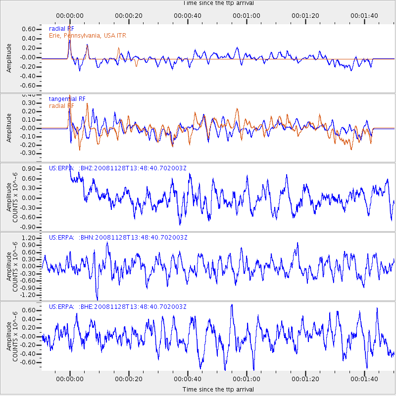
ERPA Erie, Pennsylvania, USA - Earthquake Result Viewer
*The percent match for this event was below the threshold and hence no stack was calculated.
| Earthquake location: |
Off Coast Of Northern California |
| Earthquake latitude/longitude: |
40.3/-127.0 |
| Earthquake time(UTC): |
2008/11/28 (333) 13:42:18 GMT |
| Earthquake Depth: |
10 km |
| Earthquake Magnitude: |
5.5 MS, 5.4 MB, 5.9 MW, 5.9 MW |
| Earthquake Catalog/Contributor: |
WHDF/NEIC |
|
| Network: |
US United States National Seismic Network |
| Station: |
ERPA Erie, Pennsylvania, USA |
| Lat/Lon: |
42.12 N/79.99 W |
| Elevation: |
306 m |
|
| Distance: |
35.0 deg |
| Az: |
71.374 deg |
| Baz: |
283.238 deg |
| Ray Param: |
$rayparam |
*The percent match for this event was below the threshold and hence was not used in the summary stack. |
|
| Radial Match: |
55.031845 % |
| Radial Bump: |
400 |
| Transverse Match: |
47.00928 % |
| Transverse Bump: |
400 |
| SOD ConfigId: |
2658 |
| Insert Time: |
2010-03-05 01:13:29.593 +0000 |
| GWidth: |
2.5 |
| Max Bumps: |
400 |
| Tol: |
0.001 |
|
Signal To Noise
| Channel | StoN | STA | LTA |
| US:ERPA: :BHN:20081128T13:48:40.702003Z | 1.1168283 | 2.467504E-7 | 2.2093855E-7 |
| US:ERPA: :BHE:20081128T13:48:40.702003Z | 1.606256 | 3.0075455E-7 | 1.872395E-7 |
| US:ERPA: :BHZ:20081128T13:48:40.702003Z | 0.882343 | 2.7777665E-7 | 3.1481707E-7 |
| Arrivals |
| Ps | |
| PpPs | |
| PsPs/PpSs | |


