You are here: Home > Network List > US - United States National Seismic Network Stations List
> Station ERPA Erie, Pennsylvania, USA > Earthquake Result Viewer
ERPA Erie, Pennsylvania, USA - Earthquake Result Viewer
*The percent match for this event was below the threshold and hence no stack was calculated.
| Earthquake location: |
Chile-Bolivia Border Region |
| Earthquake latitude/longitude: |
-21.4/-68.3 |
| Earthquake time(UTC): |
2008/12/04 (339) 16:47:09 GMT |
| Earthquake Depth: |
115 km |
| Earthquake Magnitude: |
5.5 MB, 5.5 MW, 5.5 MW |
| Earthquake Catalog/Contributor: |
WHDF/NEIC |
|
| Network: |
US United States National Seismic Network |
| Station: |
ERPA Erie, Pennsylvania, USA |
| Lat/Lon: |
42.12 N/79.99 W |
| Elevation: |
306 m |
|
| Distance: |
64.1 deg |
| Az: |
350.344 deg |
| Baz: |
167.872 deg |
| Ray Param: |
$rayparam |
*The percent match for this event was below the threshold and hence was not used in the summary stack. |
|
| Radial Match: |
46.22498 % |
| Radial Bump: |
400 |
| Transverse Match: |
20.601637 % |
| Transverse Bump: |
400 |
| SOD ConfigId: |
2658 |
| Insert Time: |
2010-03-05 01:13:31.433 +0000 |
| GWidth: |
2.5 |
| Max Bumps: |
400 |
| Tol: |
0.001 |
|
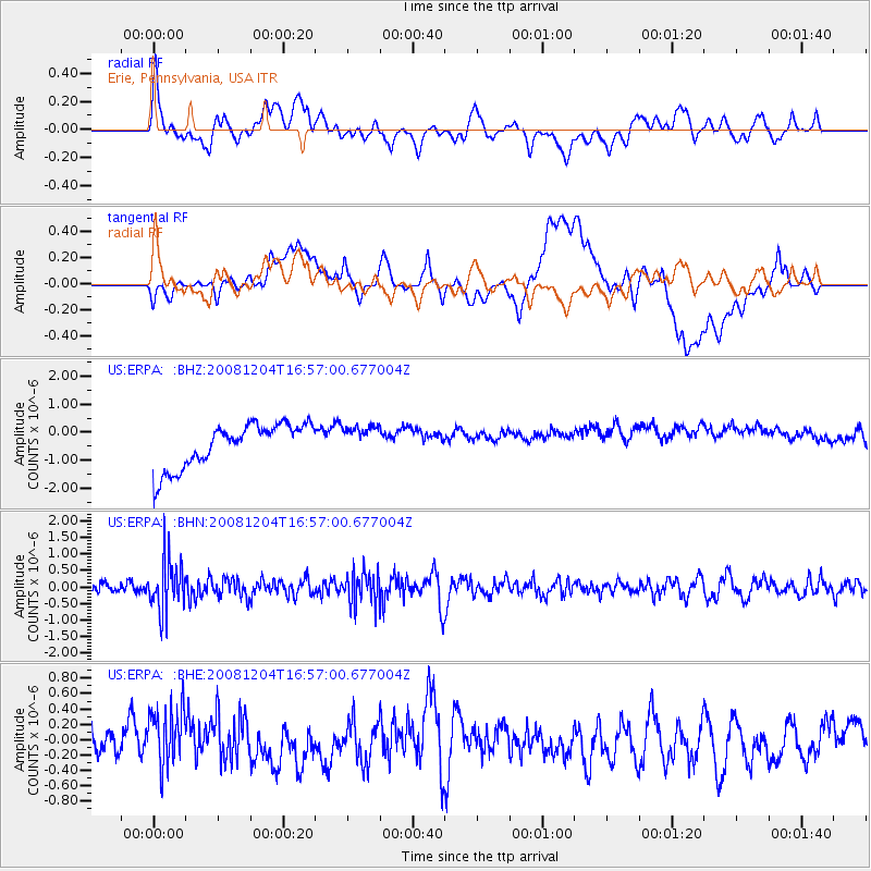
Signal To Noise
| Channel | StoN | STA | LTA |
| US:ERPA: :BHN:20081204T16:57:00.677004Z | 3.081981 | 7.6522383E-7 | 2.482896E-7 |
| US:ERPA: :BHE:20081204T16:57:00.677004Z | 2.0468256 | 3.7581304E-7 | 1.8360774E-7 |
| US:ERPA: :BHZ:20081204T16:57:00.677004Z | 0.68633944 | 5.3348913E-7 | 7.772964E-7 |
| Arrivals |
| Ps | |
| PpPs | |
| PsPs/PpSs | |


