You are here: Home > Network List > US - United States National Seismic Network Stations List
> Station ERPA Erie, Pennsylvania, USA > Earthquake Result Viewer
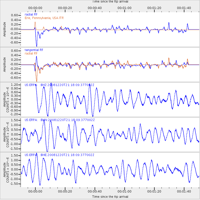
ERPA Erie, Pennsylvania, USA - Earthquake Result Viewer
*The percent match for this event was below the threshold and hence no stack was calculated.
| Earthquake location: |
Southern Mid-Atlantic Ridge |
| Earthquake latitude/longitude: |
-31.2/-13.3 |
| Earthquake time(UTC): |
2008/12/20 (355) 21:05:16 GMT |
| Earthquake Depth: |
4.0 km |
| Earthquake Magnitude: |
5.8 MB, 5.6 MS, 5.8 MW, 5.8 MW |
| Earthquake Catalog/Contributor: |
WHDF/NEIC |
|
| Network: |
US United States National Seismic Network |
| Station: |
ERPA Erie, Pennsylvania, USA |
| Lat/Lon: |
42.12 N/79.99 W |
| Elevation: |
306 m |
|
| Distance: |
95.3 deg |
| Az: |
316.688 deg |
| Baz: |
127.804 deg |
| Ray Param: |
$rayparam |
*The percent match for this event was below the threshold and hence was not used in the summary stack. |
|
| Radial Match: |
66.69017 % |
| Radial Bump: |
400 |
| Transverse Match: |
66.68441 % |
| Transverse Bump: |
400 |
| SOD ConfigId: |
2658 |
| Insert Time: |
2010-03-05 01:13:49.381 +0000 |
| GWidth: |
2.5 |
| Max Bumps: |
400 |
| Tol: |
0.001 |
|
Signal To Noise
| Channel | StoN | STA | LTA |
| US:ERPA: :BHN:20081220T21:18:09.377002Z | 0.5224822 | 4.486916E-7 | 8.5876906E-7 |
| US:ERPA: :BHE:20081220T21:18:09.377002Z | 2.0912924 | 1.0767627E-6 | 5.1487905E-7 |
| US:ERPA: :BHZ:20081220T21:18:09.377002Z | 0.6689922 | 4.4076899E-7 | 6.588552E-7 |
| Arrivals |
| Ps | |
| PpPs | |
| PsPs/PpSs | |


