You are here: Home > Network List > GS - US Geological Survey Networks Stations List
> Station KAN13 Rinehart Farm > Earthquake Result Viewer
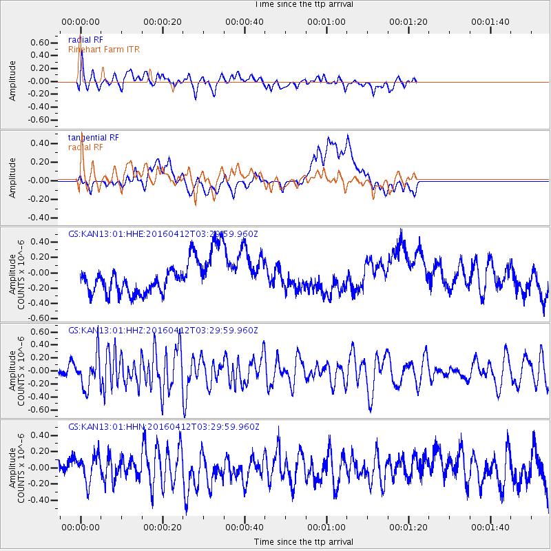
KAN13 Rinehart Farm - Earthquake Result Viewer
*The percent match for this event was below the threshold and hence no stack was calculated.
| Earthquake location: |
Central East Pacific Rise |
| Earthquake latitude/longitude: |
-3.8/-103.9 |
| Earthquake time(UTC): |
2016/04/12 (103) 03:22:47 GMT |
| Earthquake Depth: |
10 km |
| Earthquake Magnitude: |
5.8 Mwb |
| Earthquake Catalog/Contributor: |
NEIC PDE/us |
|
| Network: |
GS US Geological Survey Networks |
| Station: |
KAN13 Rinehart Farm |
| Lat/Lon: |
37.01 N/97.48 W |
| Elevation: |
340 m |
|
| Distance: |
41.0 deg |
| Az: |
7.888 deg |
| Baz: |
189.851 deg |
| Ray Param: |
$rayparam |
*The percent match for this event was below the threshold and hence was not used in the summary stack. |
|
| Radial Match: |
62.769424 % |
| Radial Bump: |
400 |
| Transverse Match: |
27.174831 % |
| Transverse Bump: |
400 |
| SOD ConfigId: |
7422571 |
| Insert Time: |
2019-04-22 05:17:07.949 +0000 |
| GWidth: |
2.5 |
| Max Bumps: |
400 |
| Tol: |
0.001 |
|
Signal To Noise
| Channel | StoN | STA | LTA |
| GS:KAN13:01:HHZ:20160412T03:29:59.960Z | 1.2501645 | 2.6113116E-7 | 2.0887745E-7 |
| GS:KAN13:01:HHN:20160412T03:29:59.960Z | 0.9494391 | 1.6595281E-7 | 1.7479037E-7 |
| GS:KAN13:01:HHE:20160412T03:29:59.960Z | 3.6781974 | 4.5816023E-7 | 1.2456107E-7 |
| Arrivals |
| Ps | |
| PpPs | |
| PsPs/PpSs | |


