You are here: Home > Network List > IU - Global Seismograph Network (GSN - IRIS/USGS) Stations List
> Station RSSD Black Hills, South Dakota, USA > Earthquake Result Viewer
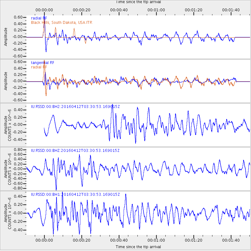
RSSD Black Hills, South Dakota, USA - Earthquake Result Viewer
*The percent match for this event was below the threshold and hence no stack was calculated.
| Earthquake location: |
Central East Pacific Rise |
| Earthquake latitude/longitude: |
-3.8/-103.9 |
| Earthquake time(UTC): |
2016/04/12 (103) 03:22:47 GMT |
| Earthquake Depth: |
10 km |
| Earthquake Magnitude: |
5.8 Mwb |
| Earthquake Catalog/Contributor: |
NEIC PDE/us |
|
| Network: |
IU Global Seismograph Network (GSN - IRIS/USGS) |
| Station: |
RSSD Black Hills, South Dakota, USA |
| Lat/Lon: |
44.12 N/104.04 W |
| Elevation: |
2090 m |
|
| Distance: |
47.7 deg |
| Az: |
359.903 deg |
| Baz: |
179.866 deg |
| Ray Param: |
$rayparam |
*The percent match for this event was below the threshold and hence was not used in the summary stack. |
|
| Radial Match: |
71.90517 % |
| Radial Bump: |
400 |
| Transverse Match: |
47.576283 % |
| Transverse Bump: |
400 |
| SOD ConfigId: |
7422571 |
| Insert Time: |
2019-04-22 05:17:28.341 +0000 |
| GWidth: |
2.5 |
| Max Bumps: |
400 |
| Tol: |
0.001 |
|
Signal To Noise
| Channel | StoN | STA | LTA |
| IU:RSSD:00:BHZ:20160412T03:30:53.169015Z | 4.0884314 | 2.0355513E-7 | 4.9788078E-8 |
| IU:RSSD:00:BH1:20160412T03:30:53.169015Z | 2.6138694 | 2.1888904E-7 | 8.3741384E-8 |
| IU:RSSD:00:BH2:20160412T03:30:53.169015Z | 0.8551461 | 9.733989E-8 | 1.1382838E-7 |
| Arrivals |
| Ps | |
| PpPs | |
| PsPs/PpSs | |


