You are here: Home > Network List > CI - Caltech Regional Seismic Network Stations List
> Station BAR Barrett, Tecate, CA, USA > Earthquake Result Viewer
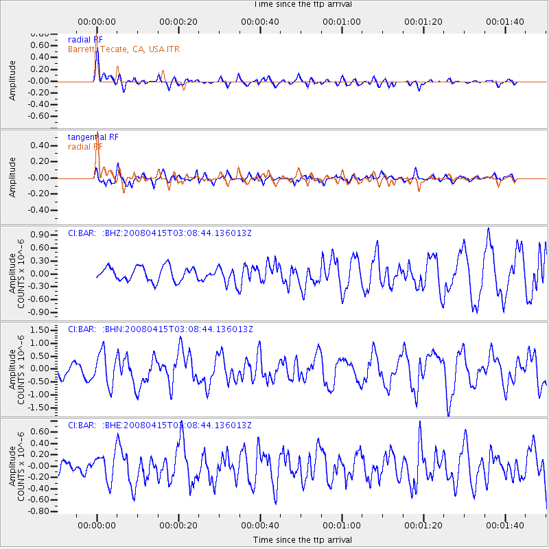
BAR Barrett, Tecate, CA, USA - Earthquake Result Viewer
*The percent match for this event was below the threshold and hence no stack was calculated.
| Earthquake location: |
Near Coast Of Guatemala |
| Earthquake latitude/longitude: |
13.6/-90.6 |
| Earthquake time(UTC): |
2008/04/15 (106) 03:03:04 GMT |
| Earthquake Depth: |
33 km |
| Earthquake Magnitude: |
5.6 MB, 5.8 MS, 6.1 MW, 6.1 MW |
| Earthquake Catalog/Contributor: |
WHDF/NEIC |
|
| Network: |
CI Caltech Regional Seismic Network |
| Station: |
BAR Barrett, Tecate, CA, USA |
| Lat/Lon: |
32.68 N/116.67 W |
| Elevation: |
521 m |
|
| Distance: |
30.5 deg |
| Az: |
313.033 deg |
| Baz: |
122.554 deg |
| Ray Param: |
$rayparam |
*The percent match for this event was below the threshold and hence was not used in the summary stack. |
|
| Radial Match: |
63.658962 % |
| Radial Bump: |
400 |
| Transverse Match: |
82.445946 % |
| Transverse Bump: |
400 |
| SOD ConfigId: |
2504 |
| Insert Time: |
2010-02-26 00:13:25.294 +0000 |
| GWidth: |
2.5 |
| Max Bumps: |
400 |
| Tol: |
0.001 |
|
Signal To Noise
| Channel | StoN | STA | LTA |
| CI:BAR: :BHN:20080415T03:08:44.136013Z | 2.0672884 | 6.3900796E-7 | 3.0910442E-7 |
| CI:BAR: :BHE:20080415T03:08:44.136013Z | 2.1057503 | 2.4095937E-7 | 1.1442922E-7 |
| CI:BAR: :BHZ:20080415T03:08:44.136013Z | 1.3089219 | 2.1207559E-7 | 1.620231E-7 |
| Arrivals |
| Ps | |
| PpPs | |
| PsPs/PpSs | |


