You are here: Home > Network List > TA - USArray Transportable Network (new EarthScope stations) Stations List
> Station R11A Troy Canyon, Currant, NV, USA > Earthquake Result Viewer
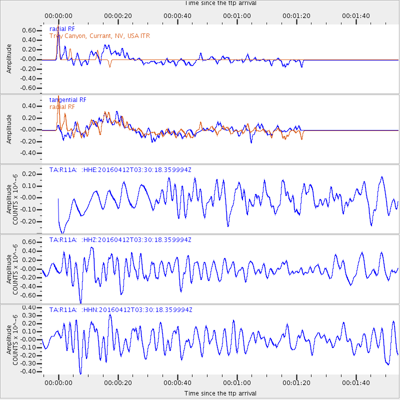
R11A Troy Canyon, Currant, NV, USA - Earthquake Result Viewer
*The percent match for this event was below the threshold and hence no stack was calculated.
| Earthquake location: |
Central East Pacific Rise |
| Earthquake latitude/longitude: |
-3.8/-103.9 |
| Earthquake time(UTC): |
2016/04/12 (103) 03:22:47 GMT |
| Earthquake Depth: |
10 km |
| Earthquake Magnitude: |
5.8 Mwb |
| Earthquake Catalog/Contributor: |
NEIC PDE/us |
|
| Network: |
TA USArray Transportable Network (new EarthScope stations) |
| Station: |
R11A Troy Canyon, Currant, NV, USA |
| Lat/Lon: |
38.35 N/115.59 W |
| Elevation: |
1756 m |
|
| Distance: |
43.3 deg |
| Az: |
346.606 deg |
| Baz: |
162.903 deg |
| Ray Param: |
$rayparam |
*The percent match for this event was below the threshold and hence was not used in the summary stack. |
|
| Radial Match: |
58.191902 % |
| Radial Bump: |
400 |
| Transverse Match: |
54.84062 % |
| Transverse Bump: |
400 |
| SOD ConfigId: |
7422571 |
| Insert Time: |
2019-04-22 05:20:40.437 +0000 |
| GWidth: |
2.5 |
| Max Bumps: |
400 |
| Tol: |
0.001 |
|
Signal To Noise
| Channel | StoN | STA | LTA |
| TA:R11A: :HHZ:20160412T03:30:18.359994Z | 2.8389971 | 1.8939384E-7 | 6.671153E-8 |
| TA:R11A: :HHN:20160412T03:30:18.359994Z | 1.1009747 | 1.8641873E-7 | 1.6932154E-7 |
| TA:R11A: :HHE:20160412T03:30:18.359994Z | 0.7164125 | 7.23732E-8 | 1.0102169E-7 |
| Arrivals |
| Ps | |
| PpPs | |
| PsPs/PpSs | |


