You are here: Home > Network List > AV - Alaska Volcano Observatory Stations List
> Station AUJA Augustine Junction, Augustine Volcano, Alaska > Earthquake Result Viewer
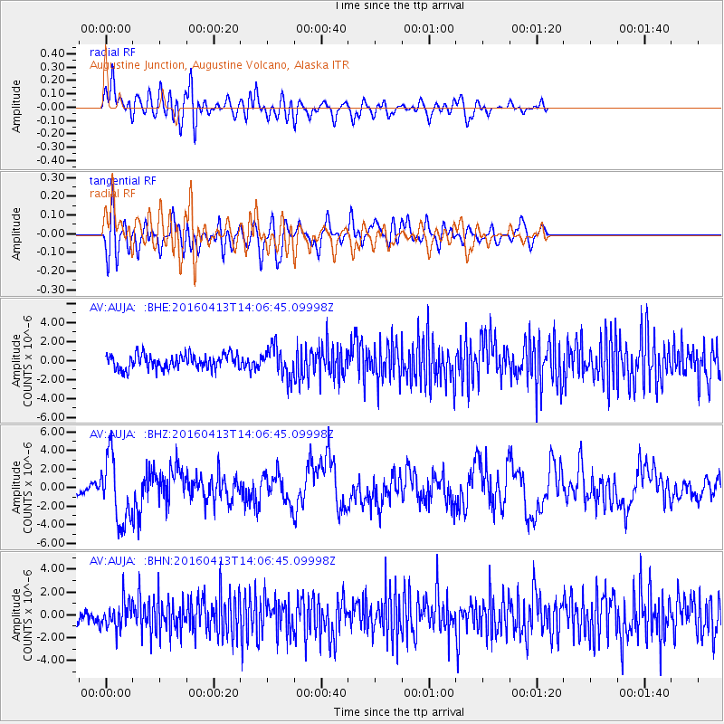
AUJA Augustine Junction, Augustine Volcano, Alaska - Earthquake Result Viewer
*The percent match for this event was below the threshold and hence no stack was calculated.
| Earthquake location: |
Myanmar-India Border Region |
| Earthquake latitude/longitude: |
23.1/94.9 |
| Earthquake time(UTC): |
2016/04/13 (104) 13:55:17 GMT |
| Earthquake Depth: |
135 km |
| Earthquake Magnitude: |
6.9 MWB |
| Earthquake Catalog/Contributor: |
NEIC PDE/NEIC COMCAT |
|
| Network: |
AV Alaska Volcano Observatory |
| Station: |
AUJA Augustine Junction, Augustine Volcano, Alaska |
| Lat/Lon: |
59.34 N/153.42 W |
| Elevation: |
376 m |
|
| Distance: |
80.7 deg |
| Az: |
28.852 deg |
| Baz: |
299.914 deg |
| Ray Param: |
$rayparam |
*The percent match for this event was below the threshold and hence was not used in the summary stack. |
|
| Radial Match: |
73.82814 % |
| Radial Bump: |
400 |
| Transverse Match: |
67.033966 % |
| Transverse Bump: |
400 |
| SOD ConfigId: |
7422571 |
| Insert Time: |
2019-04-22 05:27:34.733 +0000 |
| GWidth: |
2.5 |
| Max Bumps: |
400 |
| Tol: |
0.001 |
|
Signal To Noise
| Channel | StoN | STA | LTA |
| AV:AUJA: :BHZ:20160413T14:06:45.09998Z | 9.145817 | 3.5633736E-6 | 3.8961787E-7 |
| AV:AUJA: :BHN:20160413T14:06:45.09998Z | 2.5812562 | 1.1458214E-6 | 4.4390072E-7 |
| AV:AUJA: :BHE:20160413T14:06:45.09998Z | 2.1120155 | 1.5830586E-6 | 7.4954875E-7 |
| Arrivals |
| Ps | |
| PpPs | |
| PsPs/PpSs | |


