You are here: Home > Network List > GS - US Geological Survey Networks Stations List
> Station KAN10 Keim Farm, Anthony, KS, USA > Earthquake Result Viewer
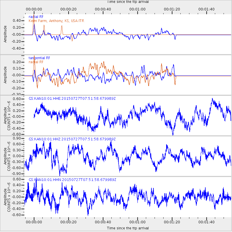
KAN10 Keim Farm, Anthony, KS, USA - Earthquake Result Viewer
*The percent match for this event was below the threshold and hence no stack was calculated.
| Earthquake location: |
Fox Islands, Aleutian Islands |
| Earthquake latitude/longitude: |
52.4/-169.5 |
| Earthquake time(UTC): |
2015/07/27 (208) 07:43:32 GMT |
| Earthquake Depth: |
48 km |
| Earthquake Magnitude: |
5.7 MB |
| Earthquake Catalog/Contributor: |
NEIC PDE/NEIC COMCAT |
|
| Network: |
GS US Geological Survey Networks |
| Station: |
KAN10 Keim Farm, Anthony, KS, USA |
| Lat/Lon: |
37.12 N/98.10 W |
| Elevation: |
417 m |
|
| Distance: |
50.9 deg |
| Az: |
77.526 deg |
| Baz: |
311.488 deg |
| Ray Param: |
$rayparam |
*The percent match for this event was below the threshold and hence was not used in the summary stack. |
|
| Radial Match: |
44.429546 % |
| Radial Bump: |
400 |
| Transverse Match: |
45.26983 % |
| Transverse Bump: |
400 |
| SOD ConfigId: |
1085051 |
| Insert Time: |
2015-08-10 08:01:41.557 +0000 |
| GWidth: |
2.5 |
| Max Bumps: |
400 |
| Tol: |
0.001 |
|
Signal To Noise
| Channel | StoN | STA | LTA |
| GS:KAN10:01:HHZ:20150727T07:51:58.679989Z | 1.1587062 | 3.0749118E-7 | 2.6537458E-7 |
| GS:KAN10:01:HHN:20150727T07:51:58.679989Z | 1.3627421 | 2.8409912E-7 | 2.0847607E-7 |
| GS:KAN10:01:HHE:20150727T07:51:58.679989Z | 3.7571661 | 4.1613626E-7 | 1.1075801E-7 |
| Arrivals |
| Ps | |
| PpPs | |
| PsPs/PpSs | |


