You are here: Home > Network List > TA - USArray Transportable Network (new EarthScope stations) Stations List
> Station I23K Minto, Yukon-Koyukuk, AK, USA > Earthquake Result Viewer
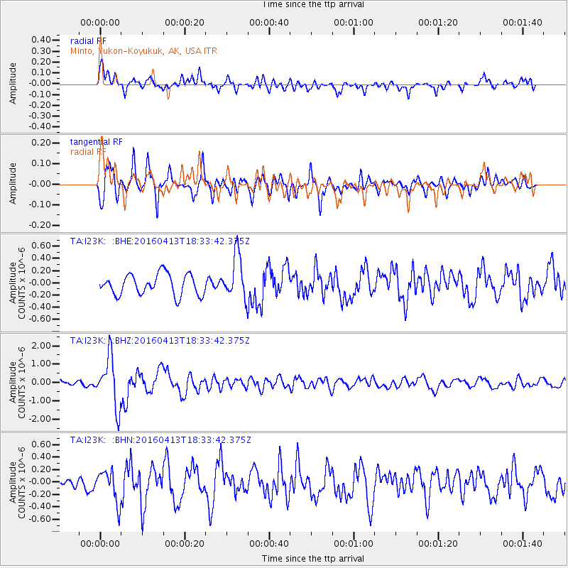
I23K Minto, Yukon-Koyukuk, AK, USA - Earthquake Result Viewer
*The percent match for this event was below the threshold and hence no stack was calculated.
| Earthquake location: |
Mindanao, Philippines |
| Earthquake latitude/longitude: |
7.8/121.9 |
| Earthquake time(UTC): |
2016/04/13 (104) 18:21:51 GMT |
| Earthquake Depth: |
10 km |
| Earthquake Magnitude: |
5.9 MWB |
| Earthquake Catalog/Contributor: |
NEIC PDE/NEIC COMCAT |
|
| Network: |
TA USArray Transportable Network (new EarthScope stations) |
| Station: |
I23K Minto, Yukon-Koyukuk, AK, USA |
| Lat/Lon: |
65.15 N/149.36 W |
| Elevation: |
149 m |
|
| Distance: |
82.4 deg |
| Az: |
25.23 deg |
| Baz: |
272.152 deg |
| Ray Param: |
$rayparam |
*The percent match for this event was below the threshold and hence was not used in the summary stack. |
|
| Radial Match: |
75.48683 % |
| Radial Bump: |
400 |
| Transverse Match: |
77.44104 % |
| Transverse Bump: |
400 |
| SOD ConfigId: |
7422571 |
| Insert Time: |
2019-04-22 05:36:52.640 +0000 |
| GWidth: |
2.5 |
| Max Bumps: |
400 |
| Tol: |
0.001 |
|
Signal To Noise
| Channel | StoN | STA | LTA |
| TA:I23K: :BHZ:20160413T18:33:42.375Z | 8.215415 | 1.4079682E-6 | 1.7138126E-7 |
| TA:I23K: :BHN:20160413T18:33:42.375Z | 2.1183453 | 2.6484392E-7 | 1.2502396E-7 |
| TA:I23K: :BHE:20160413T18:33:42.375Z | 2.1399627 | 3.635999E-7 | 1.6990947E-7 |
| Arrivals |
| Ps | |
| PpPs | |
| PsPs/PpSs | |


