You are here: Home > Network List > CI - Caltech Regional Seismic Network Stations List
> Station BAR Barrett, Tecate, CA, USA > Earthquake Result Viewer
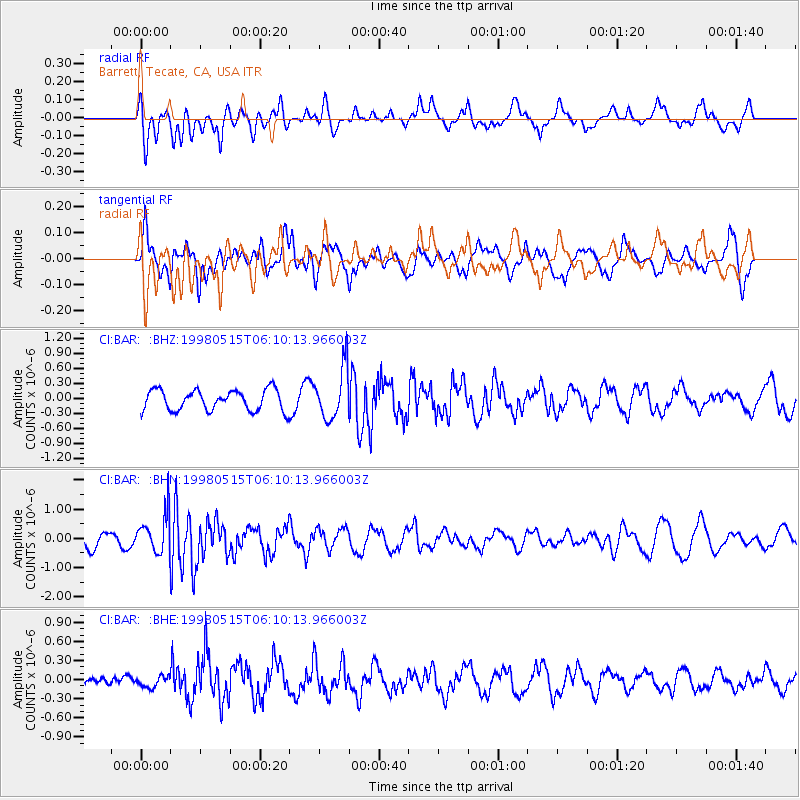
BAR Barrett, Tecate, CA, USA - Earthquake Result Viewer
*The percent match for this event was below the threshold and hence no stack was calculated.
| Earthquake location: |
Mariana Islands |
| Earthquake latitude/longitude: |
14.2/144.9 |
| Earthquake time(UTC): |
1998/05/15 (135) 05:58:06 GMT |
| Earthquake Depth: |
154 km |
| Earthquake Magnitude: |
5.7 MB, 6.0 UNKNOWN, 6.0 MW |
| Earthquake Catalog/Contributor: |
WHDF/NEIC |
|
| Network: |
CI Caltech Regional Seismic Network |
| Station: |
BAR Barrett, Tecate, CA, USA |
| Lat/Lon: |
32.68 N/116.67 W |
| Elevation: |
521 m |
|
| Distance: |
89.4 deg |
| Az: |
56.537 deg |
| Baz: |
286.371 deg |
| Ray Param: |
$rayparam |
*The percent match for this event was below the threshold and hence was not used in the summary stack. |
|
| Radial Match: |
61.108494 % |
| Radial Bump: |
400 |
| Transverse Match: |
69.52589 % |
| Transverse Bump: |
400 |
| SOD ConfigId: |
4480 |
| Insert Time: |
2010-02-26 00:13:37.960 +0000 |
| GWidth: |
2.5 |
| Max Bumps: |
400 |
| Tol: |
0.001 |
|
Signal To Noise
| Channel | StoN | STA | LTA |
| CI:BAR: :BHN:19980515T06:10:13.966003Z | 2.1673882 | 6.8164314E-7 | 3.1449977E-7 |
| CI:BAR: :BHE:19980515T06:10:13.966003Z | 0.3843842 | 8.4055884E-8 | 2.1867673E-7 |
| CI:BAR: :BHZ:19980515T06:10:13.966003Z | 2.5077674 | 5.155905E-7 | 2.0559742E-7 |
| Arrivals |
| Ps | |
| PpPs | |
| PsPs/PpSs | |


