You are here: Home > Network List > CI - Caltech Regional Seismic Network Stations List
> Station MPM Manuel Prospect Mine, California, USA > Earthquake Result Viewer
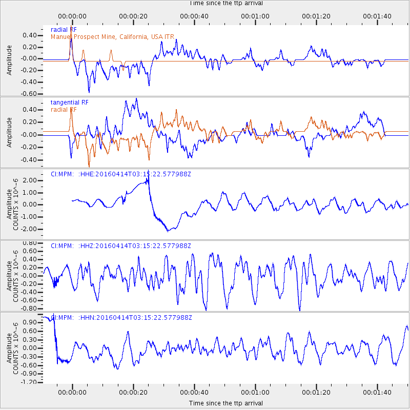
MPM Manuel Prospect Mine, California, USA - Earthquake Result Viewer
*The percent match for this event was below the threshold and hence no stack was calculated.
| Earthquake location: |
Near East Coast Of Kamchatka |
| Earthquake latitude/longitude: |
53.9/160.7 |
| Earthquake time(UTC): |
2016/04/14 (105) 03:06:09 GMT |
| Earthquake Depth: |
36 km |
| Earthquake Magnitude: |
5.8 MWW, 5.7 MWB, 5.8 MWC |
| Earthquake Catalog/Contributor: |
NEIC PDE/NEIC COMCAT |
|
| Network: |
CI Caltech Regional Seismic Network |
| Station: |
MPM Manuel Prospect Mine, California, USA |
| Lat/Lon: |
36.06 N/117.49 W |
| Elevation: |
185 m |
|
| Distance: |
57.3 deg |
| Az: |
72.446 deg |
| Baz: |
315.808 deg |
| Ray Param: |
$rayparam |
*The percent match for this event was below the threshold and hence was not used in the summary stack. |
|
| Radial Match: |
28.18063 % |
| Radial Bump: |
400 |
| Transverse Match: |
15.289994 % |
| Transverse Bump: |
400 |
| SOD ConfigId: |
7422571 |
| Insert Time: |
2019-04-22 05:41:03.731 +0000 |
| GWidth: |
2.5 |
| Max Bumps: |
400 |
| Tol: |
0.001 |
|
Signal To Noise
| Channel | StoN | STA | LTA |
| CI:MPM: :HHZ:20160414T03:15:22.577988Z | 1.1044505 | 2.0169509E-7 | 1.826203E-7 |
| CI:MPM: :HHN:20160414T03:15:22.577988Z | 0.50429606 | 2.9972088E-7 | 5.943351E-7 |
| CI:MPM: :HHE:20160414T03:15:22.577988Z | 3.6998947 | 2.4399396E-6 | 6.5946193E-7 |
| Arrivals |
| Ps | |
| PpPs | |
| PsPs/PpSs | |


