You are here: Home > Network List > CI - Caltech Regional Seismic Network Stations List
> Station BAR Barrett, Tecate, CA, USA > Earthquake Result Viewer
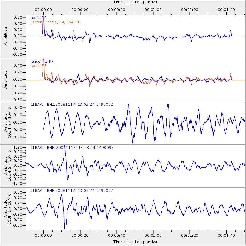
BAR Barrett, Tecate, CA, USA - Earthquake Result Viewer
*The percent match for this event was below the threshold and hence no stack was calculated.
| Earthquake location: |
Arctic Ocean |
| Earthquake latitude/longitude: |
79.6/-116.1 |
| Earthquake time(UTC): |
2008/11/17 (322) 12:55:22 GMT |
| Earthquake Depth: |
7.0 km |
| Earthquake Magnitude: |
5.7 MW, 5.2 MS, 5.4 MB, 5.7 MW |
| Earthquake Catalog/Contributor: |
WHDF/NEIC |
|
| Network: |
CI Caltech Regional Seismic Network |
| Station: |
BAR Barrett, Tecate, CA, USA |
| Lat/Lon: |
32.68 N/116.67 W |
| Elevation: |
521 m |
|
| Distance: |
47.1 deg |
| Az: |
180.71 deg |
| Baz: |
0.152 deg |
| Ray Param: |
$rayparam |
*The percent match for this event was below the threshold and hence was not used in the summary stack. |
|
| Radial Match: |
65.405945 % |
| Radial Bump: |
400 |
| Transverse Match: |
62.84239 % |
| Transverse Bump: |
400 |
| SOD ConfigId: |
2658 |
| Insert Time: |
2010-02-26 00:13:40.184 +0000 |
| GWidth: |
2.5 |
| Max Bumps: |
400 |
| Tol: |
0.001 |
|
Signal To Noise
| Channel | StoN | STA | LTA |
| CI:BAR: :BHN:20081117T13:03:24.149009Z | 0.96087885 | 1.5754296E-7 | 1.6395714E-7 |
| CI:BAR: :BHE:20081117T13:03:24.149009Z | 2.3304987 | 2.0789228E-7 | 8.920506E-8 |
| CI:BAR: :BHZ:20081117T13:03:24.149009Z | 0.49146122 | 5.193188E-8 | 1.0566832E-7 |
| Arrivals |
| Ps | |
| PpPs | |
| PsPs/PpSs | |


