You are here: Home > Network List > TJ - Tajikistan National Seismic Network Stations List
> Station GARM Garm, Tajikistan > Earthquake Result Viewer
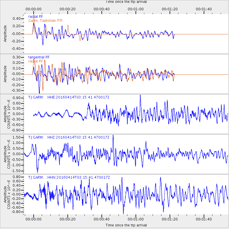
GARM Garm, Tajikistan - Earthquake Result Viewer
*The percent match for this event was below the threshold and hence no stack was calculated.
| Earthquake location: |
Near East Coast Of Kamchatka |
| Earthquake latitude/longitude: |
53.9/160.7 |
| Earthquake time(UTC): |
2016/04/14 (105) 03:06:09 GMT |
| Earthquake Depth: |
36 km |
| Earthquake Magnitude: |
5.8 MWW, 5.7 MWB, 5.8 MWC |
| Earthquake Catalog/Contributor: |
NEIC PDE/NEIC COMCAT |
|
| Network: |
TJ Tajikistan National Seismic Network |
| Station: |
GARM Garm, Tajikistan |
| Lat/Lon: |
39.00 N/70.32 E |
| Elevation: |
1305 m |
|
| Distance: |
59.9 deg |
| Az: |
295.76 deg |
| Baz: |
43.214 deg |
| Ray Param: |
$rayparam |
*The percent match for this event was below the threshold and hence was not used in the summary stack. |
|
| Radial Match: |
73.49028 % |
| Radial Bump: |
400 |
| Transverse Match: |
73.32144 % |
| Transverse Bump: |
400 |
| SOD ConfigId: |
7422571 |
| Insert Time: |
2019-04-22 05:49:27.573 +0000 |
| GWidth: |
2.5 |
| Max Bumps: |
400 |
| Tol: |
0.001 |
|
Signal To Noise
| Channel | StoN | STA | LTA |
| TJ:GARM: :HHZ:20160414T03:15:41.470017Z | 6.2354884 | 6.933733E-7 | 1.1119791E-7 |
| TJ:GARM: :HHN:20160414T03:15:41.470017Z | 2.4538536 | 1.8020556E-7 | 7.3437775E-8 |
| TJ:GARM: :HHE:20160414T03:15:41.470017Z | 2.9499784 | 2.7727782E-7 | 9.399317E-8 |
| Arrivals |
| Ps | |
| PpPs | |
| PsPs/PpSs | |


