You are here: Home > Network List > GS - US Geological Survey Networks Stations List
> Station KAN10 Keim Farm, Anthony, KS, USA > Earthquake Result Viewer
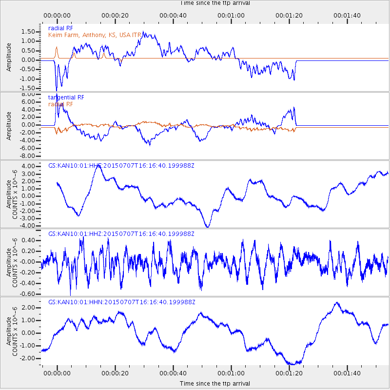
KAN10 Keim Farm, Anthony, KS, USA - Earthquake Result Viewer
*The percent match for this event was below the threshold and hence no stack was calculated.
| Earthquake location: |
Central East Pacific Rise |
| Earthquake latitude/longitude: |
-13.4/-111.3 |
| Earthquake time(UTC): |
2015/07/07 (188) 16:08:03 GMT |
| Earthquake Depth: |
10 km |
| Earthquake Magnitude: |
5.7 MWW, 5.7 MWC |
| Earthquake Catalog/Contributor: |
NEIC PDE/NEIC COMCAT |
|
| Network: |
GS US Geological Survey Networks |
| Station: |
KAN10 Keim Farm, Anthony, KS, USA |
| Lat/Lon: |
37.12 N/98.10 W |
| Elevation: |
417 m |
|
| Distance: |
51.8 deg |
| Az: |
13.44 deg |
| Baz: |
196.44 deg |
| Ray Param: |
$rayparam |
*The percent match for this event was below the threshold and hence was not used in the summary stack. |
|
| Radial Match: |
51.737534 % |
| Radial Bump: |
400 |
| Transverse Match: |
58.569603 % |
| Transverse Bump: |
400 |
| SOD ConfigId: |
1085051 |
| Insert Time: |
2015-08-11 20:43:04.969 +0000 |
| GWidth: |
2.5 |
| Max Bumps: |
400 |
| Tol: |
0.001 |
|
Signal To Noise
| Channel | StoN | STA | LTA |
| GS:KAN10:01:HHZ:20150707T16:16:40.199988Z | 1.4178101 | 2.1421026E-7 | 1.510853E-7 |
| GS:KAN10:01:HHN:20150707T16:16:40.199988Z | 1.5141344 | 1.5537364E-6 | 1.0261549E-6 |
| GS:KAN10:01:HHE:20150707T16:16:40.199988Z | 0.8615259 | 1.5998264E-6 | 1.8569685E-6 |
| Arrivals |
| Ps | |
| PpPs | |
| PsPs/PpSs | |


