You are here: Home > Network List > TA - USArray Transportable Network (new EarthScope stations) Stations List
> Station 435B Jarrell, TX, USA > Earthquake Result Viewer
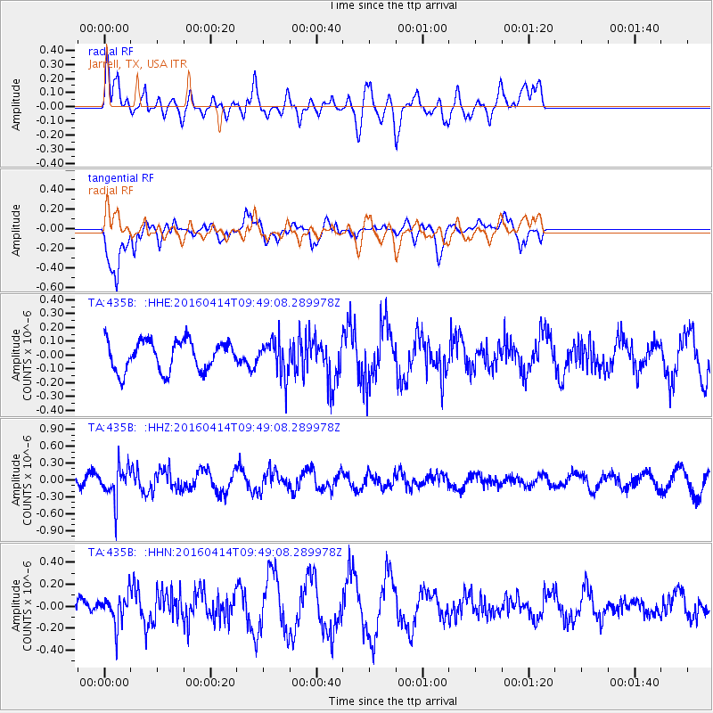
435B Jarrell, TX, USA - Earthquake Result Viewer
*The percent match for this event was below the threshold and hence no stack was calculated.
| Earthquake location: |
Chile-Argentina Border Region |
| Earthquake latitude/longitude: |
-33.9/-70.4 |
| Earthquake time(UTC): |
2016/04/14 (105) 09:38:44 GMT |
| Earthquake Depth: |
112 km |
| Earthquake Magnitude: |
5.5 MB |
| Earthquake Catalog/Contributor: |
NEIC PDE/NEIC ALERT |
|
| Network: |
TA USArray Transportable Network (new EarthScope stations) |
| Station: |
435B Jarrell, TX, USA |
| Lat/Lon: |
30.78 N/97.58 W |
| Elevation: |
248 m |
|
| Distance: |
69.2 deg |
| Az: |
335.152 deg |
| Baz: |
156.026 deg |
| Ray Param: |
$rayparam |
*The percent match for this event was below the threshold and hence was not used in the summary stack. |
|
| Radial Match: |
67.64687 % |
| Radial Bump: |
400 |
| Transverse Match: |
74.779335 % |
| Transverse Bump: |
400 |
| SOD ConfigId: |
7422571 |
| Insert Time: |
2019-04-22 05:59:01.562 +0000 |
| GWidth: |
2.5 |
| Max Bumps: |
400 |
| Tol: |
0.001 |
|
Signal To Noise
| Channel | StoN | STA | LTA |
| TA:435B: :HHZ:20160414T09:49:08.289978Z | 3.0095115 | 2.9641663E-7 | 9.8493274E-8 |
| TA:435B: :HHN:20160414T09:49:08.289978Z | 1.9673276 | 1.3727599E-7 | 6.97779E-8 |
| TA:435B: :HHE:20160414T09:49:08.289978Z | 1.1401118 | 1.2469259E-7 | 1.0936875E-7 |
| Arrivals |
| Ps | |
| PpPs | |
| PsPs/PpSs | |


