You are here: Home > Network List > CI - Caltech Regional Seismic Network Stations List
> Station MPM Manuel Prospect Mine, California, USA > Earthquake Result Viewer
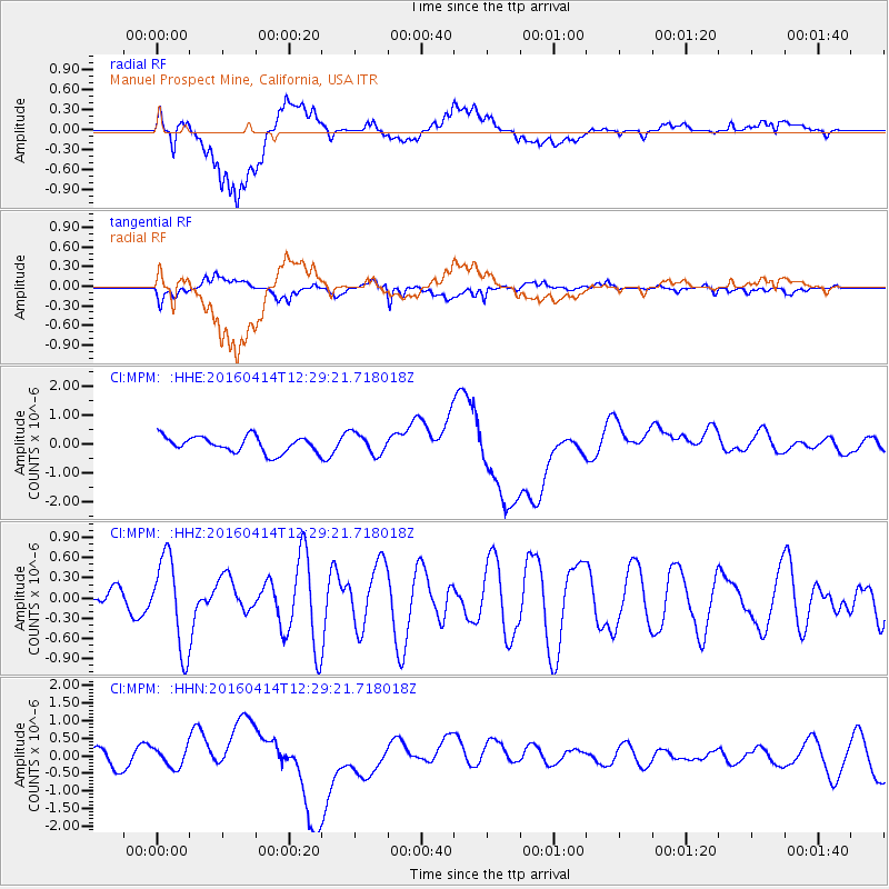
MPM Manuel Prospect Mine, California, USA - Earthquake Result Viewer
*The percent match for this event was below the threshold and hence no stack was calculated.
| Earthquake location: |
Vanuatu Islands |
| Earthquake latitude/longitude: |
-14.5/166.5 |
| Earthquake time(UTC): |
2016/04/14 (105) 12:17:05 GMT |
| Earthquake Depth: |
10 km |
| Earthquake Magnitude: |
6.0 MO |
| Earthquake Catalog/Contributor: |
NEIC PDE/NEIC ALERT |
|
| Network: |
CI Caltech Regional Seismic Network |
| Station: |
MPM Manuel Prospect Mine, California, USA |
| Lat/Lon: |
36.06 N/117.49 W |
| Elevation: |
185 m |
|
| Distance: |
87.5 deg |
| Az: |
51.914 deg |
| Baz: |
250.189 deg |
| Ray Param: |
$rayparam |
*The percent match for this event was below the threshold and hence was not used in the summary stack. |
|
| Radial Match: |
37.73054 % |
| Radial Bump: |
400 |
| Transverse Match: |
56.68299 % |
| Transverse Bump: |
400 |
| SOD ConfigId: |
7422571 |
| Insert Time: |
2019-04-22 06:05:09.740 +0000 |
| GWidth: |
2.5 |
| Max Bumps: |
400 |
| Tol: |
0.001 |
|
Signal To Noise
| Channel | StoN | STA | LTA |
| CI:MPM: :HHZ:20160414T12:29:21.718018Z | 3.1219494 | 6.774095E-7 | 2.1698285E-7 |
| CI:MPM: :HHN:20160414T12:29:21.718018Z | 1.2314771 | 2.8055817E-7 | 2.2782247E-7 |
| CI:MPM: :HHE:20160414T12:29:21.718018Z | 1.3871063 | 3.796021E-7 | 2.7366477E-7 |
| Arrivals |
| Ps | |
| PpPs | |
| PsPs/PpSs | |


