You are here: Home > Network List > TA - USArray Transportable Network (new EarthScope stations) Stations List
> Station T25A Trinidad, CO, USA > Earthquake Result Viewer
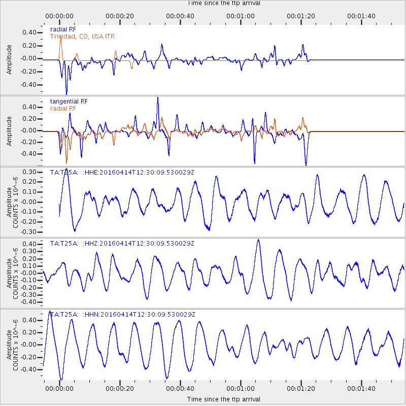
T25A Trinidad, CO, USA - Earthquake Result Viewer
*The percent match for this event was below the threshold and hence no stack was calculated.
| Earthquake location: |
Vanuatu Islands |
| Earthquake latitude/longitude: |
-14.5/166.5 |
| Earthquake time(UTC): |
2016/04/14 (105) 12:17:05 GMT |
| Earthquake Depth: |
10 km |
| Earthquake Magnitude: |
6.0 MO |
| Earthquake Catalog/Contributor: |
NEIC PDE/NEIC ALERT |
|
| Network: |
TA USArray Transportable Network (new EarthScope stations) |
| Station: |
T25A Trinidad, CO, USA |
| Lat/Lon: |
37.14 N/104.41 W |
| Elevation: |
2017 m |
|
| Distance: |
97.9 deg |
| Az: |
53.774 deg |
| Baz: |
257.886 deg |
| Ray Param: |
$rayparam |
*The percent match for this event was below the threshold and hence was not used in the summary stack. |
|
| Radial Match: |
63.45266 % |
| Radial Bump: |
372 |
| Transverse Match: |
59.48514 % |
| Transverse Bump: |
260 |
| SOD ConfigId: |
7422571 |
| Insert Time: |
2019-04-22 06:07:36.256 +0000 |
| GWidth: |
2.5 |
| Max Bumps: |
400 |
| Tol: |
0.001 |
|
Signal To Noise
| Channel | StoN | STA | LTA |
| TA:T25A: :HHZ:20160414T12:30:09.530029Z | 1.0778131 | 1.0542479E-7 | 9.7813604E-8 |
| TA:T25A: :HHN:20160414T12:30:09.530029Z | 1.7490282 | 3.4094268E-7 | 1.9493264E-7 |
| TA:T25A: :HHE:20160414T12:30:09.530029Z | 0.520245 | 6.850707E-8 | 1.3168233E-7 |
| Arrivals |
| Ps | |
| PpPs | |
| PsPs/PpSs | |


