You are here: Home > Network List > CI - Caltech Regional Seismic Network Stations List
> Station BAR Barrett, Tecate, CA, USA > Earthquake Result Viewer
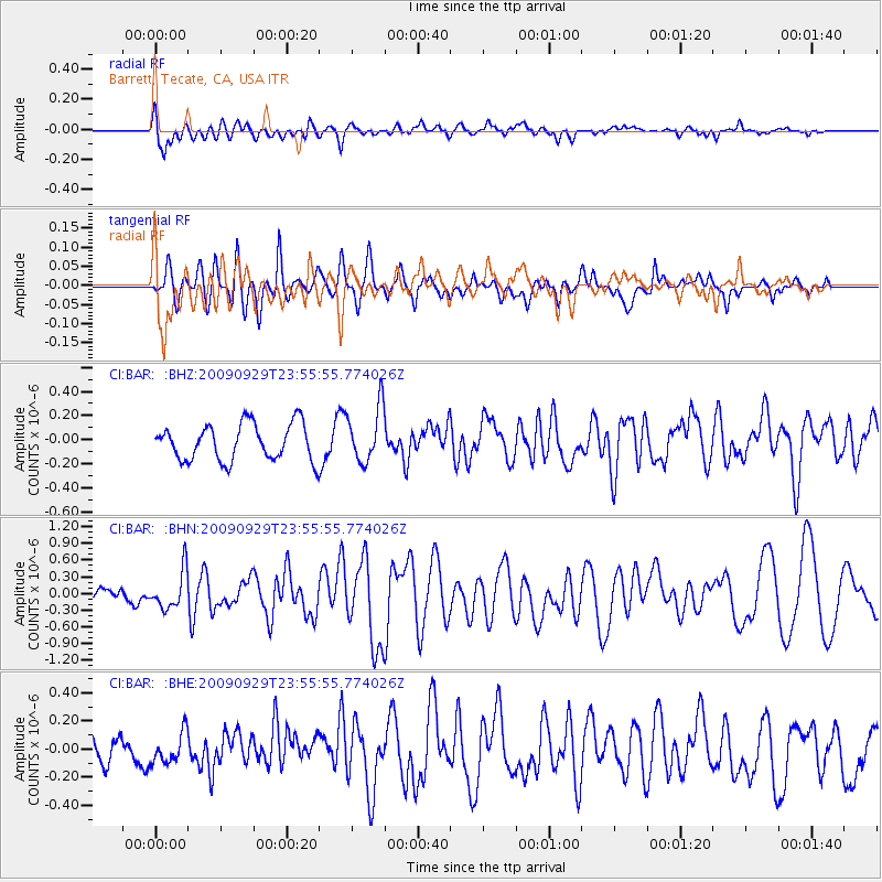
BAR Barrett, Tecate, CA, USA - Earthquake Result Viewer
*The percent match for this event was below the threshold and hence no stack was calculated.
| Earthquake location: |
Samoa Islands Region |
| Earthquake latitude/longitude: |
-15.8/-172.6 |
| Earthquake time(UTC): |
2009/09/29 (272) 23:45:03 GMT |
| Earthquake Depth: |
10 km |
| Earthquake Magnitude: |
6.0 MB, 5.8 MS |
| Earthquake Catalog/Contributor: |
WHDF/NEIC |
|
| Network: |
CI Caltech Regional Seismic Network |
| Station: |
BAR Barrett, Tecate, CA, USA |
| Lat/Lon: |
32.68 N/116.67 W |
| Elevation: |
521 m |
|
| Distance: |
72.0 deg |
| Az: |
47.244 deg |
| Baz: |
236.933 deg |
| Ray Param: |
$rayparam |
*The percent match for this event was below the threshold and hence was not used in the summary stack. |
|
| Radial Match: |
71.580414 % |
| Radial Bump: |
400 |
| Transverse Match: |
70.33048 % |
| Transverse Bump: |
376 |
| SOD ConfigId: |
2622 |
| Insert Time: |
2010-02-26 00:13:56.878 +0000 |
| GWidth: |
2.5 |
| Max Bumps: |
400 |
| Tol: |
0.001 |
|
Signal To Noise
| Channel | StoN | STA | LTA |
| CI:BAR: :BHN:20090929T23:55:55.774026Z | 1.1001678 | 3.4371425E-7 | 3.1241987E-7 |
| CI:BAR: :BHE:20090929T23:55:55.774026Z | 0.82190555 | 1.06102036E-7 | 1.2909273E-7 |
| CI:BAR: :BHZ:20090929T23:55:55.774026Z | 1.519295 | 2.294408E-7 | 1.5101794E-7 |
| Arrivals |
| Ps | |
| PpPs | |
| PsPs/PpSs | |


