AGMN Agassiz National Wildlife Refuge, Minnesota, USA - Earthquake Result Viewer
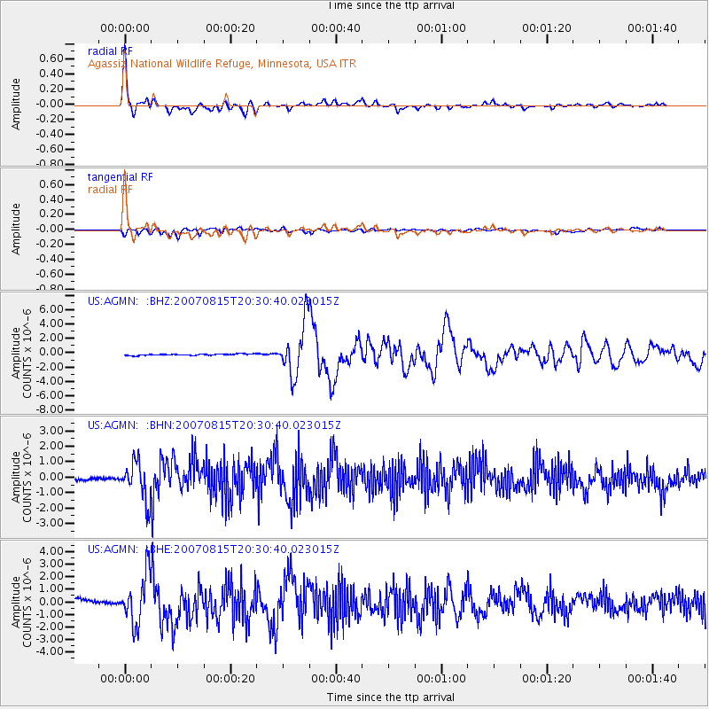
Earthquake location: Andreanof Islands, Aleutian Is.
Earthquake latitude/longitude: 50.3/-177.5
Earthquake time(UTC): 2007/08/15 (227) 20:22:11 GMT
Earthquake Depth: 9.0 km
Earthquake Magnitude: 6.3 MB, 6.2 MS, 6.4 MW, 5.9 ML
Earthquake Catalog/Contributor: WHDF/NEIC
Network: US United States National Seismic Network
Station: AGMN Agassiz National Wildlife Refuge, Minnesota, USA
Lat/Lon: 48.30 N/95.86 W
Elevation: 351 m
Distance: 50.7 deg
Az: 58.616 deg
Baz: 304.964 deg
Ray Param: 0.06787535
Estimated Moho Depth: 48.75 km
Estimated Crust Vp/Vs: 1.70
Assumed Crust Vp: 6.419 km/s
Estimated Crust Vs: 3.787 km/s
Estimated Crust Poisson's Ratio: 0.23
Radial Match: 95.5808 %
Radial Bump: 400
Transverse Match: 78.69968 %
Transverse Bump: 400
SOD ConfigId: 2564
Insert Time: 2010-03-05 01:22:54.210 +0000
GWidth: 2.5
Max Bumps: 400
Tol: 0.001

Signal To Noise

ChannelStoNSTALTA
US:AGMN: :BHN:20070815T20:30:40.023015Z15.5334211.2334588E-67.940677E-8
US:AGMN: :BHE:20070815T20:30:40.023015Z5.4165681.9860931E-63.6667004E-7
US:AGMN: :BHZ:20070815T20:30:40.023015Z36.812623.7385544E-61.0155633E-7
Arrivals
Ps5.6 SECOND
PpPs19 SECOND
PsPs/PpSs25 SECOND