AGMN Agassiz National Wildlife Refuge, Minnesota, USA - Earthquake Result Viewer
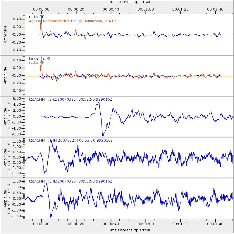
Earthquake location: Near West Coast Of Honshu, Japan
Earthquake latitude/longitude: 37.3/136.6
Earthquake time(UTC): 2007/03/25 (084) 00:41:57 GMT
Earthquake Depth: 8.0 km
Earthquake Magnitude: 6.1 MB, 6.8 MS, 6.7 MW, 6.6 MW
Earthquake Catalog/Contributor: WHDF/NEIC
Network: US United States National Seismic Network
Station: AGMN Agassiz National Wildlife Refuge, Minnesota, USA
Lat/Lon: 48.30 N/95.86 W
Elevation: 351 m
Distance: 82.8 deg
Az: 32.249 deg
Baz: 320.437 deg
Ray Param: 0.046632953
Estimated Moho Depth: 49.0 km
Estimated Crust Vp/Vs: 1.67
Assumed Crust Vp: 6.419 km/s
Estimated Crust Vs: 3.844 km/s
Estimated Crust Poisson's Ratio: 0.22
Radial Match: 92.60991 %
Radial Bump: 400
Transverse Match: 84.0045 %
Transverse Bump: 400
SOD ConfigId: 2564
Insert Time: 2010-03-05 01:23:16.434 +0000
GWidth: 2.5
Max Bumps: 400
Tol: 0.001

Signal To Noise

ChannelStoNSTALTA
US:AGMN: :BHN:20070325T00:53:50.999016Z5.6231558.1513775E-71.4496092E-7
US:AGMN: :BHE:20070325T00:53:50.999016Z9.3019697.8076863E-78.393585E-8
US:AGMN: :BHZ:20070325T00:53:50.999016Z16.268742.974892E-61.8285941E-7
Arrivals
Ps5.3 SECOND
PpPs20 SECOND
PsPs/PpSs25 SECOND