You are here: Home > Network List > CI - Caltech Regional Seismic Network Stations List
> Station MPP McPhearson Peak > Earthquake Result Viewer
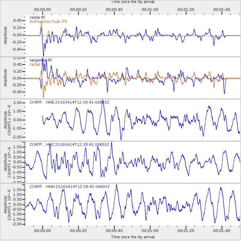
MPP McPhearson Peak - Earthquake Result Viewer
*The percent match for this event was below the threshold and hence no stack was calculated.
| Earthquake location: |
Kyushu, Japan |
| Earthquake latitude/longitude: |
32.8/130.6 |
| Earthquake time(UTC): |
2016/04/14 (105) 12:26:36 GMT |
| Earthquake Depth: |
10 km |
| Earthquake Magnitude: |
6.2 MWW |
| Earthquake Catalog/Contributor: |
NEIC PDE/NEIC COMCAT |
|
| Network: |
CI Caltech Regional Seismic Network |
| Station: |
MPP McPhearson Peak |
| Lat/Lon: |
34.89 N/119.81 W |
| Elevation: |
1739 m |
|
| Distance: |
85.7 deg |
| Az: |
50.977 deg |
| Baz: |
307.297 deg |
| Ray Param: |
$rayparam |
*The percent match for this event was below the threshold and hence was not used in the summary stack. |
|
| Radial Match: |
73.18445 % |
| Radial Bump: |
400 |
| Transverse Match: |
63.474796 % |
| Transverse Bump: |
400 |
| SOD ConfigId: |
7422571 |
| Insert Time: |
2019-04-22 06:13:00.625 +0000 |
| GWidth: |
2.5 |
| Max Bumps: |
400 |
| Tol: |
0.001 |
|
Signal To Noise
| Channel | StoN | STA | LTA |
| CI:MPP: :HHZ:20160414T12:38:43.09803Z | 2.0901756 | 1.0679147E-6 | 5.1092104E-7 |
| CI:MPP: :HHN:20160414T12:38:43.09803Z | 0.71284324 | 6.590722E-7 | 9.2456816E-7 |
| CI:MPP: :HHE:20160414T12:38:43.09803Z | 1.8044949 | 1.315946E-6 | 7.2926E-7 |
| Arrivals |
| Ps | |
| PpPs | |
| PsPs/PpSs | |


