
AGMN Agassiz National Wildlife Refuge, Minnesota, USA - Earthquake Result Viewer
| ||||||||||||||||||
| ||||||||||||||||||
| ||||||||||||||||||
|
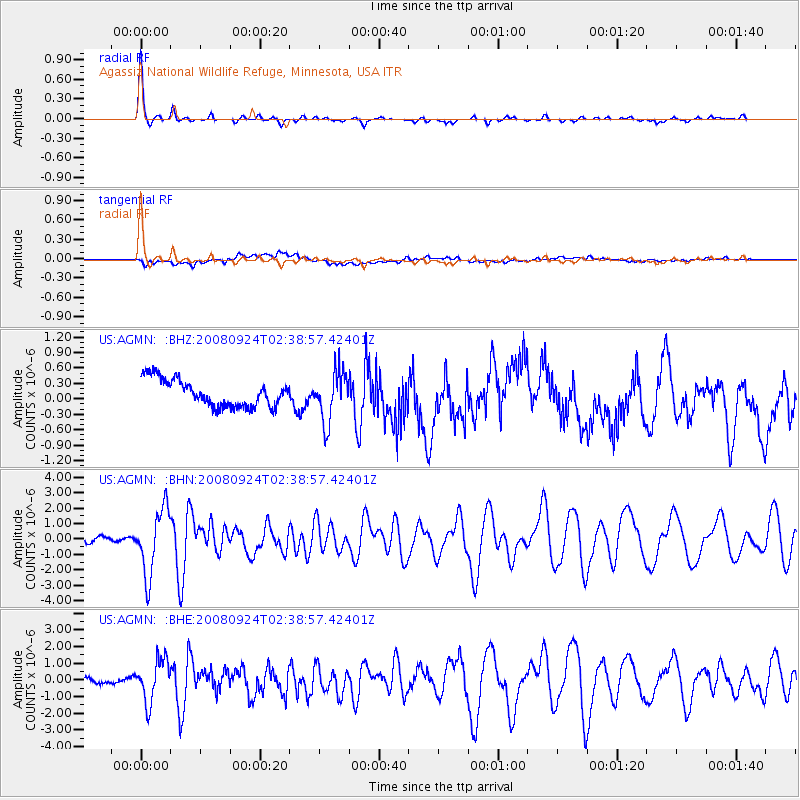
Signal To Noise
| Channel | StoN | STA | LTA |
| US:AGMN: :BHN:20080924T02:38:57.42401Z | 15.652304 | 2.1029289E-6 | 1.3435267E-7 |
| US:AGMN: :BHE:20080924T02:38:57.42401Z | 9.381557 | 1.2661925E-6 | 1.3496613E-7 |
| US:AGMN: :BHZ:20080924T02:38:57.42401Z | 1.8070978 | 4.7552476E-7 | 2.631428E-7 |
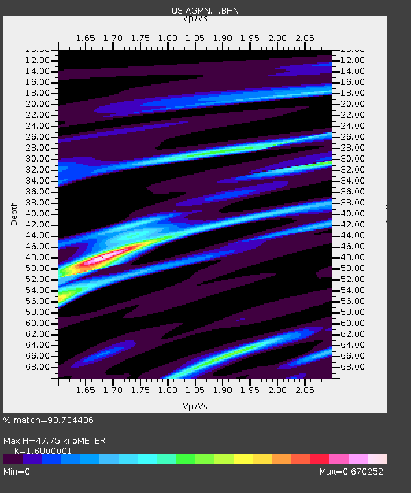
| Arrivals | |
| Ps | 5.5 SECOND |
| PpPs | 18 SECOND |
| PsPs/PpSs | 24 SECOND |

