You are here: Home > Network List > TA - USArray Transportable Network (new EarthScope stations) Stations List
> Station L19K White Mountain, AK, USA > Earthquake Result Viewer
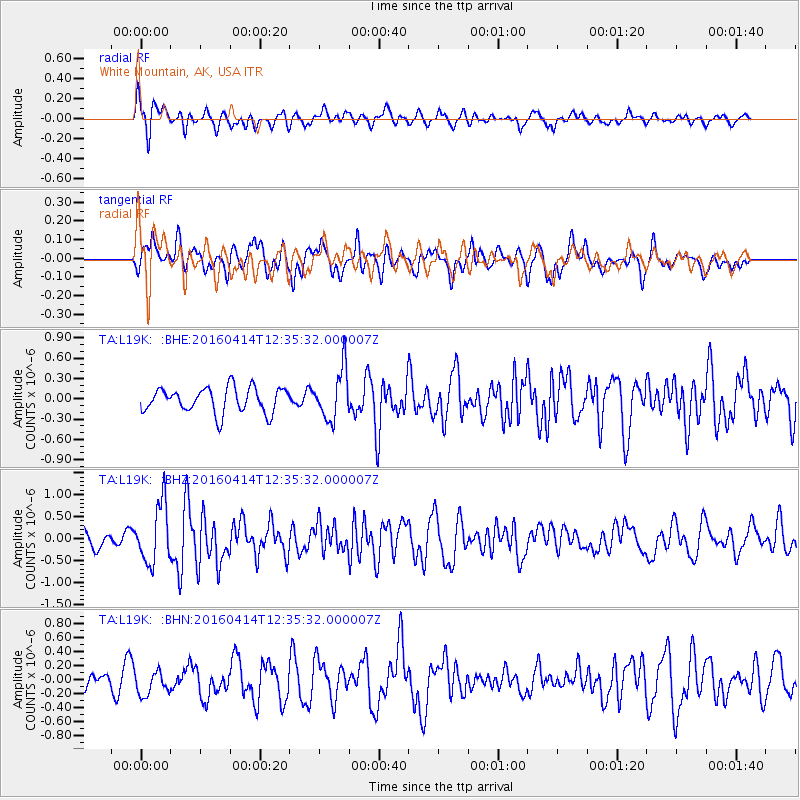
L19K White Mountain, AK, USA - Earthquake Result Viewer
*The percent match for this event was below the threshold and hence no stack was calculated.
| Earthquake location: |
Kyushu, Japan |
| Earthquake latitude/longitude: |
32.8/130.6 |
| Earthquake time(UTC): |
2016/04/14 (105) 12:26:36 GMT |
| Earthquake Depth: |
10 km |
| Earthquake Magnitude: |
6.2 MWW |
| Earthquake Catalog/Contributor: |
NEIC PDE/NEIC COMCAT |
|
| Network: |
TA USArray Transportable Network (new EarthScope stations) |
| Station: |
L19K White Mountain, AK, USA |
| Lat/Lon: |
62.18 N/154.85 W |
| Elevation: |
650 m |
|
| Distance: |
54.4 deg |
| Az: |
33.783 deg |
| Baz: |
273.861 deg |
| Ray Param: |
$rayparam |
*The percent match for this event was below the threshold and hence was not used in the summary stack. |
|
| Radial Match: |
63.453724 % |
| Radial Bump: |
400 |
| Transverse Match: |
65.312675 % |
| Transverse Bump: |
400 |
| SOD ConfigId: |
7422571 |
| Insert Time: |
2019-04-22 06:17:05.453 +0000 |
| GWidth: |
2.5 |
| Max Bumps: |
400 |
| Tol: |
0.001 |
|
Signal To Noise
| Channel | StoN | STA | LTA |
| TA:L19K: :BHZ:20160414T12:35:32.000007Z | 2.0530694 | 6.670124E-7 | 3.2488543E-7 |
| TA:L19K: :BHN:20160414T12:35:32.000007Z | 1.0507779 | 1.7306736E-7 | 1.6470403E-7 |
| TA:L19K: :BHE:20160414T12:35:32.000007Z | 2.0322995 | 3.7183426E-7 | 1.8296234E-7 |
| Arrivals |
| Ps | |
| PpPs | |
| PsPs/PpSs | |


