You are here: Home > Network List > CI - Caltech Regional Seismic Network Stations List
> Station BAR Barrett, Tecate, CA, USA > Earthquake Result Viewer
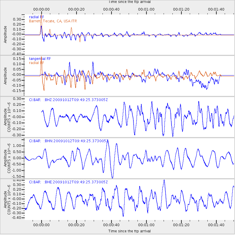
BAR Barrett, Tecate, CA, USA - Earthquake Result Viewer
*The percent match for this event was below the threshold and hence no stack was calculated.
| Earthquake location: |
Santa Cruz Islands |
| Earthquake latitude/longitude: |
-12.4/166.5 |
| Earthquake time(UTC): |
2009/10/12 (285) 09:37:21 GMT |
| Earthquake Depth: |
42 km |
| Earthquake Magnitude: |
5.9 MB, 5.9 MS, 6.2 MW, 6.2 MW |
| Earthquake Catalog/Contributor: |
WHDF/NEIC |
|
| Network: |
CI Caltech Regional Seismic Network |
| Station: |
BAR Barrett, Tecate, CA, USA |
| Lat/Lon: |
32.68 N/116.67 W |
| Elevation: |
521 m |
|
| Distance: |
85.8 deg |
| Az: |
55.422 deg |
| Baz: |
252.509 deg |
| Ray Param: |
$rayparam |
*The percent match for this event was below the threshold and hence was not used in the summary stack. |
|
| Radial Match: |
61.629784 % |
| Radial Bump: |
400 |
| Transverse Match: |
45.474766 % |
| Transverse Bump: |
400 |
| SOD ConfigId: |
2622 |
| Insert Time: |
2010-02-26 00:14:06.691 +0000 |
| GWidth: |
2.5 |
| Max Bumps: |
400 |
| Tol: |
0.001 |
|
Signal To Noise
| Channel | StoN | STA | LTA |
| CI:BAR: :BHN:20091012T09:49:25.373005Z | 3.1965942 | 4.7864637E-7 | 1.4973637E-7 |
| CI:BAR: :BHE:20091012T09:49:25.373005Z | 0.8312651 | 1.4180503E-7 | 1.7058943E-7 |
| CI:BAR: :BHZ:20091012T09:49:25.373005Z | 2.0315104 | 1.4142802E-7 | 6.961717E-8 |
| Arrivals |
| Ps | |
| PpPs | |
| PsPs/PpSs | |


