You are here: Home > Network List > US - United States National Seismic Network Stations List
> Station AGMN Agassiz National Wildlife Refuge, Minnesota, USA > Earthquake Result Viewer
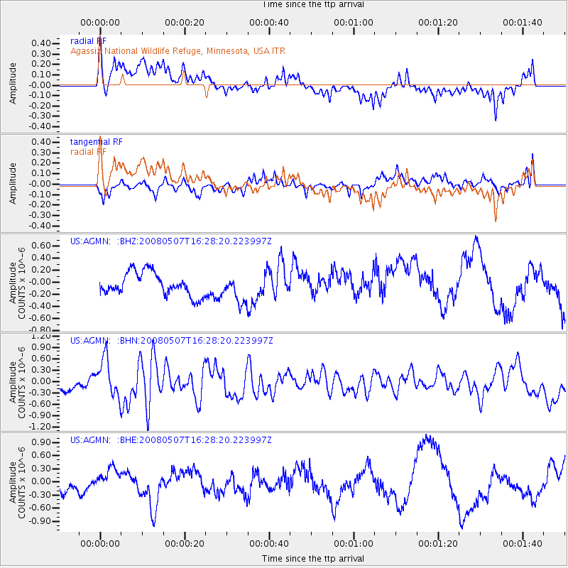
AGMN Agassiz National Wildlife Refuge, Minnesota, USA - Earthquake Result Viewer
*The percent match for this event was below the threshold and hence no stack was calculated.
| Earthquake location: |
Near East Coast Of Honshu, Japan |
| Earthquake latitude/longitude: |
36.2/141.8 |
| Earthquake time(UTC): |
2008/05/07 (128) 16:16:36 GMT |
| Earthquake Depth: |
23 km |
| Earthquake Magnitude: |
5.9 MB, 6.1 MW, 6.0 MW |
| Earthquake Catalog/Contributor: |
WHDF/NEIC |
|
| Network: |
US United States National Seismic Network |
| Station: |
AGMN Agassiz National Wildlife Refuge, Minnesota, USA |
| Lat/Lon: |
48.30 N/95.86 W |
| Elevation: |
351 m |
|
| Distance: |
81.5 deg |
| Az: |
34.762 deg |
| Baz: |
316.288 deg |
| Ray Param: |
$rayparam |
*The percent match for this event was below the threshold and hence was not used in the summary stack. |
|
| Radial Match: |
59.96841 % |
| Radial Bump: |
400 |
| Transverse Match: |
34.206047 % |
| Transverse Bump: |
400 |
| SOD ConfigId: |
2504 |
| Insert Time: |
2010-03-05 01:25:44.056 +0000 |
| GWidth: |
2.5 |
| Max Bumps: |
400 |
| Tol: |
0.001 |
|
Signal To Noise
| Channel | StoN | STA | LTA |
| US:AGMN: :BHN:20080507T16:28:20.223997Z | 4.284772 | 5.2416584E-7 | 1.2233225E-7 |
| US:AGMN: :BHE:20080507T16:28:20.223997Z | 1.4559803 | 2.384364E-7 | 1.6376349E-7 |
| US:AGMN: :BHZ:20080507T16:28:20.223997Z | 1.2466391 | 2.339081E-7 | 1.8763097E-7 |
| Arrivals |
| Ps | |
| PpPs | |
| PsPs/PpSs | |


