You are here: Home > Network List > CI - Caltech Regional Seismic Network Stations List
> Station BAR Barrett, Tecate, CA, USA > Earthquake Result Viewer
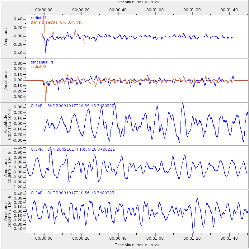
BAR Barrett, Tecate, CA, USA - Earthquake Result Viewer
*The percent match for this event was below the threshold and hence no stack was calculated.
| Earthquake location: |
Samoa Islands Region |
| Earthquake latitude/longitude: |
-16.4/-172.0 |
| Earthquake time(UTC): |
2009/10/17 (290) 10:45:26 GMT |
| Earthquake Depth: |
10 km |
| Earthquake Magnitude: |
5.7 MB, 5.3 MS, 5.7 MW, 5.7 MW |
| Earthquake Catalog/Contributor: |
WHDF/NEIC |
|
| Network: |
CI Caltech Regional Seismic Network |
| Station: |
BAR Barrett, Tecate, CA, USA |
| Lat/Lon: |
32.68 N/116.67 W |
| Elevation: |
521 m |
|
| Distance: |
71.9 deg |
| Az: |
46.842 deg |
| Baz: |
236.137 deg |
| Ray Param: |
$rayparam |
*The percent match for this event was below the threshold and hence was not used in the summary stack. |
|
| Radial Match: |
80.37849 % |
| Radial Bump: |
400 |
| Transverse Match: |
64.19469 % |
| Transverse Bump: |
392 |
| SOD ConfigId: |
2622 |
| Insert Time: |
2010-02-26 00:14:12.415 +0000 |
| GWidth: |
2.5 |
| Max Bumps: |
400 |
| Tol: |
0.001 |
|
Signal To Noise
| Channel | StoN | STA | LTA |
| CI:BAR: :BHN:20091017T10:56:18.748022Z | 2.4734533 | 6.0201774E-7 | 2.4339158E-7 |
| CI:BAR: :BHE:20091017T10:56:18.748022Z | 1.043318 | 1.14552144E-7 | 1.09796005E-7 |
| CI:BAR: :BHZ:20091017T10:56:18.748022Z | 1.3569717 | 1.587743E-7 | 1.1700634E-7 |
| Arrivals |
| Ps | |
| PpPs | |
| PsPs/PpSs | |


