You are here: Home > Network List > CN - Canadian National Seismograph Network Stations List
> Station INK INUVIK, NT > Earthquake Result Viewer
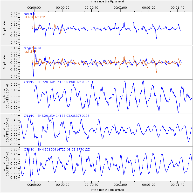
INK INUVIK, NT - Earthquake Result Viewer
*The percent match for this event was below the threshold and hence no stack was calculated.
| Earthquake location: |
Vanuatu Islands |
| Earthquake latitude/longitude: |
-14.5/166.4 |
| Earthquake time(UTC): |
2016/04/14 (105) 21:50:26 GMT |
| Earthquake Depth: |
10 km |
| Earthquake Magnitude: |
6.5 MWP, 6.2 MWB, 6.6 MI |
| Earthquake Catalog/Contributor: |
NEIC PDE/NEIC COMCAT |
|
| Network: |
CN Canadian National Seismograph Network |
| Station: |
INK INUVIK, NT |
| Lat/Lon: |
68.31 N/133.53 W |
| Elevation: |
44 m |
|
| Distance: |
93.0 deg |
| Az: |
18.823 deg |
| Baz: |
237.175 deg |
| Ray Param: |
$rayparam |
*The percent match for this event was below the threshold and hence was not used in the summary stack. |
|
| Radial Match: |
85.27511 % |
| Radial Bump: |
400 |
| Transverse Match: |
64.86274 % |
| Transverse Bump: |
400 |
| SOD ConfigId: |
7422571 |
| Insert Time: |
2019-04-22 06:39:44.254 +0000 |
| GWidth: |
2.5 |
| Max Bumps: |
400 |
| Tol: |
0.001 |
|
Signal To Noise
| Channel | StoN | STA | LTA |
| CN:INK: :BHZ:20160414T22:03:08.375012Z | 1.7536923 | 4.044699E-7 | 2.3063903E-7 |
| CN:INK: :BHN:20160414T22:03:08.375012Z | 0.8213266 | 1.5423026E-7 | 1.877819E-7 |
| CN:INK: :BHE:20160414T22:03:08.375012Z | 1.255173 | 1.22771E-7 | 9.781202E-8 |
| Arrivals |
| Ps | |
| PpPs | |
| PsPs/PpSs | |


