You are here: Home > Network List > TA - USArray Transportable Network (new EarthScope stations) Stations List
> Station O03E Paynes Creek, CA, USA > Earthquake Result Viewer
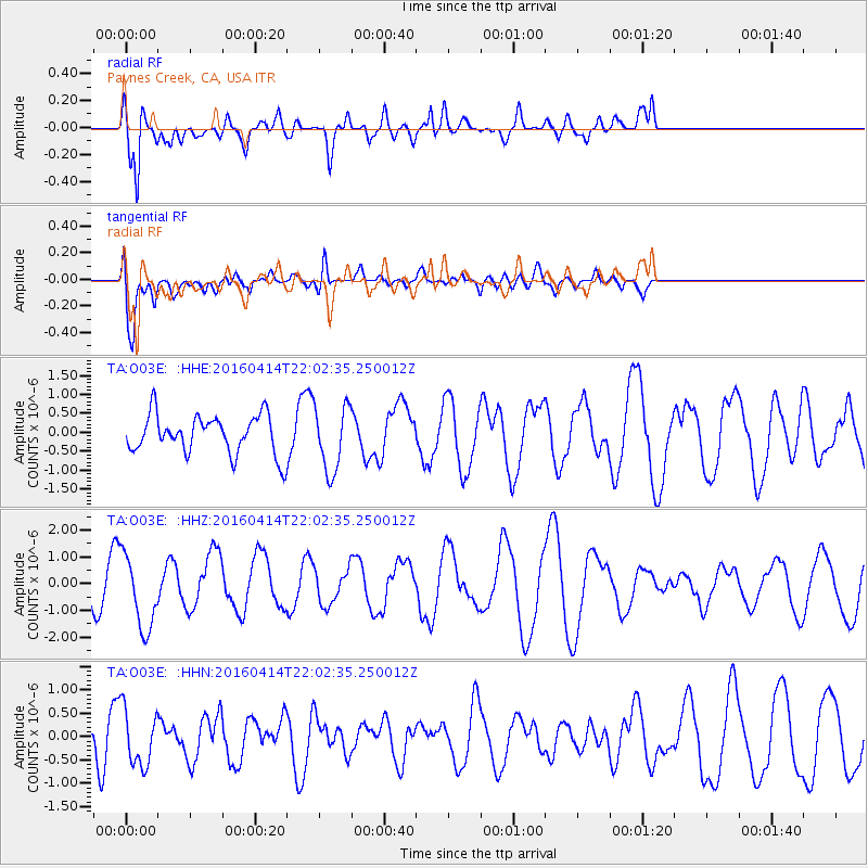
O03E Paynes Creek, CA, USA - Earthquake Result Viewer
*The percent match for this event was below the threshold and hence no stack was calculated.
| Earthquake location: |
Vanuatu Islands |
| Earthquake latitude/longitude: |
-14.5/166.4 |
| Earthquake time(UTC): |
2016/04/14 (105) 21:50:26 GMT |
| Earthquake Depth: |
10 km |
| Earthquake Magnitude: |
6.5 MWP, 6.2 MWB, 6.6 MI |
| Earthquake Catalog/Contributor: |
NEIC PDE/NEIC COMCAT |
|
| Network: |
TA USArray Transportable Network (new EarthScope stations) |
| Station: |
O03E Paynes Creek, CA, USA |
| Lat/Lon: |
40.29 N/121.80 W |
| Elevation: |
967 m |
|
| Distance: |
86.0 deg |
| Az: |
46.751 deg |
| Baz: |
247.244 deg |
| Ray Param: |
$rayparam |
*The percent match for this event was below the threshold and hence was not used in the summary stack. |
|
| Radial Match: |
76.216064 % |
| Radial Bump: |
400 |
| Transverse Match: |
54.48816 % |
| Transverse Bump: |
400 |
| SOD ConfigId: |
7422571 |
| Insert Time: |
2019-04-22 06:42:23.180 +0000 |
| GWidth: |
2.5 |
| Max Bumps: |
400 |
| Tol: |
0.001 |
|
Signal To Noise
| Channel | StoN | STA | LTA |
| TA:O03E: :HHZ:20160414T22:02:35.250012Z | 2.5395045 | 1.3701456E-6 | 5.395326E-7 |
| TA:O03E: :HHN:20160414T22:02:35.250012Z | 0.88744974 | 5.9402447E-7 | 6.6936127E-7 |
| TA:O03E: :HHE:20160414T22:02:35.250012Z | 1.629708 | 8.480604E-7 | 5.203757E-7 |
| Arrivals |
| Ps | |
| PpPs | |
| PsPs/PpSs | |


