You are here: Home > Network List > US - United States National Seismic Network Stations List
> Station DGMT Dagmar, Montana, USA > Earthquake Result Viewer
DGMT Dagmar, Montana, USA - Earthquake Result Viewer

| Earthquake location: |
Near West Coast Of Colombia |
| Earthquake latitude/longitude: |
3.0/-78.0 |
| Earthquake time(UTC): |
2007/09/10 (253) 01:49:14 GMT |
| Earthquake Depth: |
31 km |
| Earthquake Magnitude: |
6.1 MB, 6.7 MS, 6.8 MW |
| Earthquake Catalog/Contributor: |
WHDF/NEIC |
|
| Network: |
US United States National Seismic Network |
| Station: |
DGMT Dagmar, Montana, USA |
| Lat/Lon: |
48.47 N/104.20 W |
| Elevation: |
0.0 m |
|
| Distance: |
50.6 deg |
| Az: |
337.627 deg |
| Baz: |
145.168 deg |
| Ray Param: |
0.06788972 |
| Estimated Moho Depth: |
17.75 km |
| Estimated Crust Vp/Vs: |
1.85 |
| Assumed Crust Vp: |
6.438 km/s |
| Estimated Crust Vs: |
3.484 km/s |
| Estimated Crust Poisson's Ratio: |
0.29 |
|
| Radial Match: |
90.70285 % |
| Radial Bump: |
289 |
| Transverse Match: |
69.36539 % |
| Transverse Bump: |
390 |
| SOD ConfigId: |
2564 |
| Insert Time: |
2010-03-05 01:26:53.968 +0000 |
| GWidth: |
2.5 |
| Max Bumps: |
400 |
| Tol: |
0.001 |
|
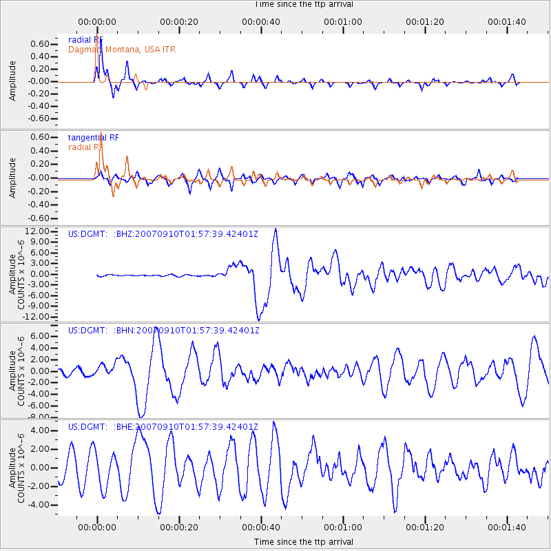
Signal To Noise
| Channel | StoN | STA | LTA |
| US:DGMT: :BHN:20070910T01:57:39.42401Z | 1.7454424 | 1.0978906E-6 | 6.2900426E-7 |
| US:DGMT: :BHE:20070910T01:57:39.42401Z | 2.1480875 | 1.929458E-6 | 8.982213E-7 |
| US:DGMT: :BHZ:20070910T01:57:39.42401Z | 11.166826 | 2.1570745E-6 | 1.9316809E-7 |
| Arrivals |
| Ps | 2.5 SECOND |
| PpPs | 7.4 SECOND |
| PsPs/PpSs | 9.9 SECOND |


