You are here: Home > Network List > US - United States National Seismic Network Stations List
> Station HAWA Hanford, Washington, USA > Earthquake Result Viewer
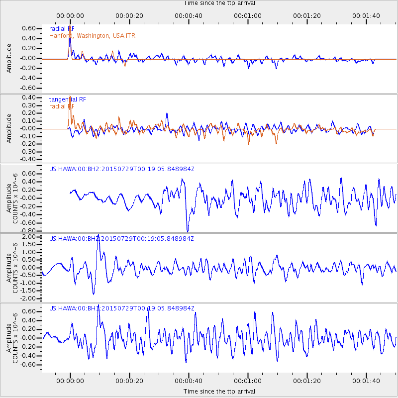
HAWA Hanford, Washington, USA - Earthquake Result Viewer
*The percent match for this event was below the threshold and hence no stack was calculated.
| Earthquake location: |
Panama-Colombia Border Region |
| Earthquake latitude/longitude: |
8.2/-77.3 |
| Earthquake time(UTC): |
2015/07/29 (210) 00:10:24 GMT |
| Earthquake Depth: |
10 km |
| Earthquake Magnitude: |
5.9 MWP, 6.1 MI |
| Earthquake Catalog/Contributor: |
NEIC PDE/NEIC COMCAT |
|
| Network: |
US United States National Seismic Network |
| Station: |
HAWA Hanford, Washington, USA |
| Lat/Lon: |
46.39 N/119.53 W |
| Elevation: |
364 m |
|
| Distance: |
52.4 deg |
| Az: |
324.049 deg |
| Baz: |
122.902 deg |
| Ray Param: |
$rayparam |
*The percent match for this event was below the threshold and hence was not used in the summary stack. |
|
| Radial Match: |
66.8444 % |
| Radial Bump: |
400 |
| Transverse Match: |
65.43598 % |
| Transverse Bump: |
400 |
| SOD ConfigId: |
1085051 |
| Insert Time: |
2015-08-12 00:28:44.049 +0000 |
| GWidth: |
2.5 |
| Max Bumps: |
400 |
| Tol: |
0.001 |
|
Signal To Noise
| Channel | StoN | STA | LTA |
| US:HAWA:00:BHZ:20150729T00:19:05.848984Z | 1.9628214 | 4.2275457E-7 | 2.1538108E-7 |
| US:HAWA:00:BH1:20150729T00:19:05.848984Z | 1.9762453 | 1.5010951E-7 | 7.5956926E-8 |
| US:HAWA:00:BH2:20150729T00:19:05.848984Z | 1.6702462 | 1.9325557E-7 | 1.1570484E-7 |
| Arrivals |
| Ps | |
| PpPs | |
| PsPs/PpSs | |


