You are here: Home > Network List > CI - Caltech Regional Seismic Network Stations List
> Station BAR Barrett, Tecate, CA, USA > Earthquake Result Viewer
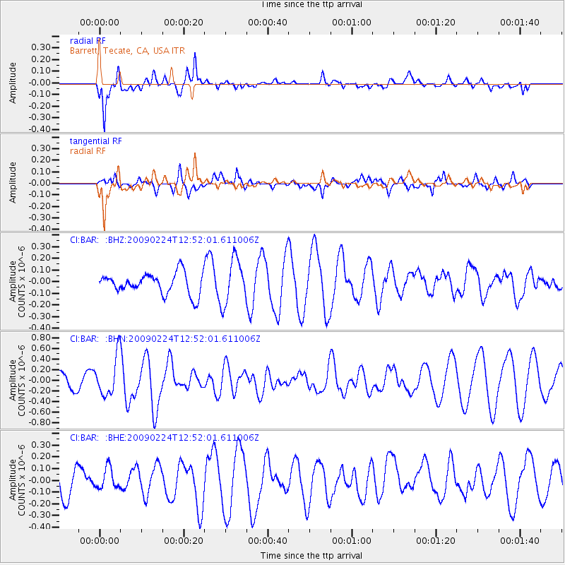
BAR Barrett, Tecate, CA, USA - Earthquake Result Viewer
*The percent match for this event was below the threshold and hence no stack was calculated.
| Earthquake location: |
Southeast Of Loyalty Islands |
| Earthquake latitude/longitude: |
-23.2/170.6 |
| Earthquake time(UTC): |
2009/02/24 (055) 12:39:41 GMT |
| Earthquake Depth: |
32 km |
| Earthquake Magnitude: |
5.6 MB, 5.7 MW, 5.6 MW |
| Earthquake Catalog/Contributor: |
WHDF/NEIC |
|
| Network: |
CI Caltech Regional Seismic Network |
| Station: |
BAR Barrett, Tecate, CA, USA |
| Lat/Lon: |
32.68 N/116.67 W |
| Elevation: |
521 m |
|
| Distance: |
88.9 deg |
| Az: |
53.673 deg |
| Baz: |
241.534 deg |
| Ray Param: |
$rayparam |
*The percent match for this event was below the threshold and hence was not used in the summary stack. |
|
| Radial Match: |
72.18054 % |
| Radial Bump: |
400 |
| Transverse Match: |
44.897003 % |
| Transverse Bump: |
400 |
| SOD ConfigId: |
2658 |
| Insert Time: |
2010-02-26 00:14:17.966 +0000 |
| GWidth: |
2.5 |
| Max Bumps: |
400 |
| Tol: |
0.001 |
|
Signal To Noise
| Channel | StoN | STA | LTA |
| CI:BAR: :BHN:20090224T12:52:01.611006Z | 2.271151 | 3.7675218E-7 | 1.6588601E-7 |
| CI:BAR: :BHE:20090224T12:52:01.611006Z | 0.91369045 | 1.0090305E-7 | 1.1043461E-7 |
| CI:BAR: :BHZ:20090224T12:52:01.611006Z | 2.1607137 | 1.9406228E-7 | 8.981398E-8 |
| Arrivals |
| Ps | |
| PpPs | |
| PsPs/PpSs | |


