DGMT Dagmar, Montana, USA - Earthquake Result Viewer
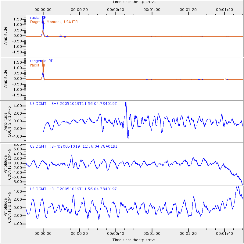
Earthquake location: Near East Coast Of Honshu, Japan
Earthquake latitude/longitude: 36.4/140.8
Earthquake time(UTC): 2005/10/19 (292) 11:44:42 GMT
Earthquake Depth: 32 km
Earthquake Magnitude: 6.2 MB, 6.5 MS, 6.4 MW, 6.3 MW
Earthquake Catalog/Contributor: WHDF/NEIC
Network: US United States National Seismic Network
Station: DGMT Dagmar, Montana, USA
Lat/Lon: 48.47 N/104.20 W
Elevation: 0.0 m
Distance: 77.6 deg
Az: 38.147 deg
Baz: 311.515 deg
Ray Param: 0.05015628
Estimated Moho Depth: 20.25 km
Estimated Crust Vp/Vs: 1.62
Assumed Crust Vp: 6.438 km/s
Estimated Crust Vs: 3.986 km/s
Estimated Crust Poisson's Ratio: 0.19
Radial Match: 99.40529 %
Radial Bump: 42
Transverse Match: 95.34205 %
Transverse Bump: 93
SOD ConfigId: 110165
Insert Time: 2010-03-05 01:26:58.292 +0000
GWidth: 2.5
Max Bumps: 400
Tol: 0.001

Signal To Noise

ChannelStoNSTALTA
US:DGMT: :BHN:20051019T11:56:04.784019Z1.03333181.2242535E-61.1847634E-6
US:DGMT: :BHE:20051019T11:56:04.784019Z1.19028961.4780078E-61.2417211E-6
US:DGMT: :BHZ:20051019T11:56:04.784019Z1.87349051.4157987E-67.55701E-7
Arrivals
Ps2.0 SECOND
PpPs8.0 SECOND
PsPs/PpSs10.0 SECOND