You are here: Home > Network List > US - United States National Seismic Network Stations List
> Station MSO Missoula, Montana, USA > Earthquake Result Viewer
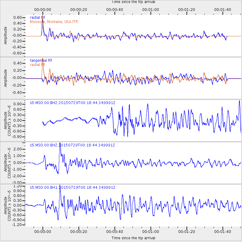
MSO Missoula, Montana, USA - Earthquake Result Viewer
*The percent match for this event was below the threshold and hence no stack was calculated.
| Earthquake location: |
Panama-Colombia Border Region |
| Earthquake latitude/longitude: |
8.2/-77.3 |
| Earthquake time(UTC): |
2015/07/29 (210) 00:10:24 GMT |
| Earthquake Depth: |
10 km |
| Earthquake Magnitude: |
5.9 MWP, 6.1 MI |
| Earthquake Catalog/Contributor: |
NEIC PDE/NEIC COMCAT |
|
| Network: |
US United States National Seismic Network |
| Station: |
MSO Missoula, Montana, USA |
| Lat/Lon: |
46.83 N/113.94 W |
| Elevation: |
1264 m |
|
| Distance: |
49.5 deg |
| Az: |
327.418 deg |
| Baz: |
129.077 deg |
| Ray Param: |
$rayparam |
*The percent match for this event was below the threshold and hence was not used in the summary stack. |
|
| Radial Match: |
78.32726 % |
| Radial Bump: |
400 |
| Transverse Match: |
55.617104 % |
| Transverse Bump: |
400 |
| SOD ConfigId: |
1085051 |
| Insert Time: |
2015-08-12 00:33:45.664 +0000 |
| GWidth: |
2.5 |
| Max Bumps: |
400 |
| Tol: |
0.001 |
|
Signal To Noise
| Channel | StoN | STA | LTA |
| US:MSO:00:BHZ:20150729T00:18:44.349991Z | 6.406207 | 4.8918974E-7 | 7.636184E-8 |
| US:MSO:00:BH1:20150729T00:18:44.349991Z | 2.7493849 | 1.9377707E-7 | 7.0480155E-8 |
| US:MSO:00:BH2:20150729T00:18:44.349991Z | 1.3658972 | 1.4639097E-7 | 1.07175694E-7 |
| Arrivals |
| Ps | |
| PpPs | |
| PsPs/PpSs | |


