You are here: Home > Network List > US - United States National Seismic Network Stations List
> Station DGMT Dagmar, Montana, USA > Earthquake Result Viewer
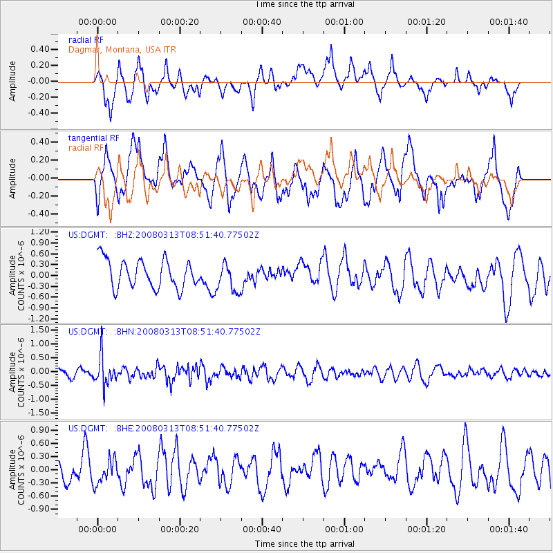
DGMT Dagmar, Montana, USA - Earthquake Result Viewer
*The percent match for this event was below the threshold and hence no stack was calculated.
| Earthquake location: |
Kuril Islands |
| Earthquake latitude/longitude: |
43.1/146.5 |
| Earthquake time(UTC): |
2008/03/13 (073) 08:41:07 GMT |
| Earthquake Depth: |
53 km |
| Earthquake Magnitude: |
5.6 MB, 5.4 MW, 5.3 MW |
| Earthquake Catalog/Contributor: |
WHDF/NEIC |
|
| Network: |
US United States National Seismic Network |
| Station: |
DGMT Dagmar, Montana, USA |
| Lat/Lon: |
48.47 N/104.20 W |
| Elevation: |
0.0 m |
|
| Distance: |
69.7 deg |
| Az: |
42.049 deg |
| Baz: |
312.477 deg |
| Ray Param: |
$rayparam |
*The percent match for this event was below the threshold and hence was not used in the summary stack. |
|
| Radial Match: |
46.782425 % |
| Radial Bump: |
400 |
| Transverse Match: |
61.027763 % |
| Transverse Bump: |
400 |
| SOD ConfigId: |
2504 |
| Insert Time: |
2010-03-05 01:27:58.278 +0000 |
| GWidth: |
2.5 |
| Max Bumps: |
400 |
| Tol: |
0.001 |
|
Signal To Noise
| Channel | StoN | STA | LTA |
| US:DGMT: :BHN:20080313T08:51:40.77502Z | 3.811826 | 5.1798054E-7 | 1.3588777E-7 |
| US:DGMT: :BHE:20080313T08:51:40.77502Z | 0.9910111 | 2.853124E-7 | 2.8790032E-7 |
| US:DGMT: :BHZ:20080313T08:51:40.77502Z | 1.0126027 | 3.9376715E-7 | 3.8886643E-7 |
| Arrivals |
| Ps | |
| PpPs | |
| PsPs/PpSs | |


