You are here: Home > Network List > US - United States National Seismic Network Stations List
> Station DGMT Dagmar, Montana, USA > Earthquake Result Viewer
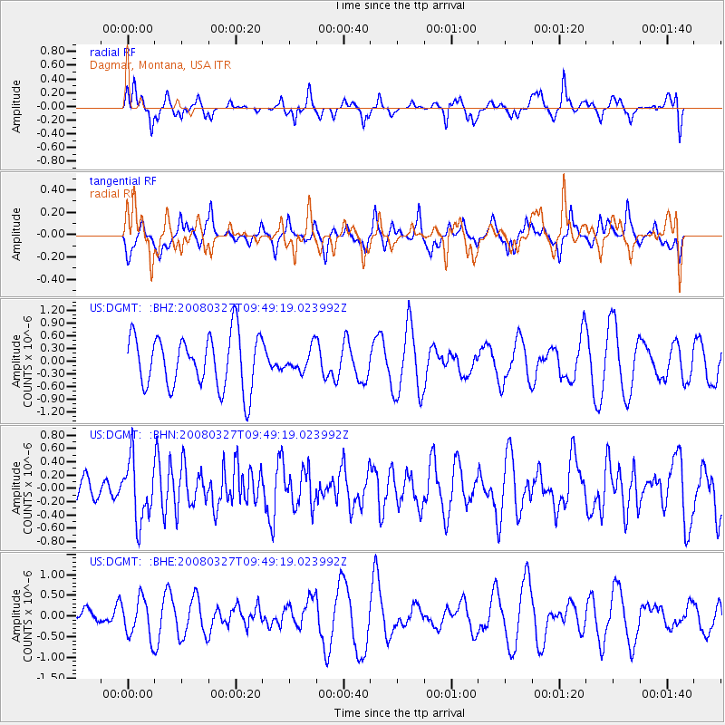
DGMT Dagmar, Montana, USA - Earthquake Result Viewer
*The percent match for this event was below the threshold and hence no stack was calculated.
| Earthquake location: |
North Of Honduras |
| Earthquake latitude/longitude: |
17.2/-84.8 |
| Earthquake time(UTC): |
2008/03/27 (087) 09:42:57 GMT |
| Earthquake Depth: |
10 km |
| Earthquake Magnitude: |
5.6 MW, 5.1 MS, 5.4 MB, 5.6 MW |
| Earthquake Catalog/Contributor: |
WHDF/NEIC |
|
| Network: |
US United States National Seismic Network |
| Station: |
DGMT Dagmar, Montana, USA |
| Lat/Lon: |
48.47 N/104.20 W |
| Elevation: |
0.0 m |
|
| Distance: |
35.0 deg |
| Az: |
337.358 deg |
| Baz: |
146.433 deg |
| Ray Param: |
$rayparam |
*The percent match for this event was below the threshold and hence was not used in the summary stack. |
|
| Radial Match: |
49.6214 % |
| Radial Bump: |
369 |
| Transverse Match: |
48.459663 % |
| Transverse Bump: |
323 |
| SOD ConfigId: |
2504 |
| Insert Time: |
2010-03-05 01:28:02.345 +0000 |
| GWidth: |
2.5 |
| Max Bumps: |
400 |
| Tol: |
0.001 |
|
Signal To Noise
| Channel | StoN | STA | LTA |
| US:DGMT: :BHN:20080327T09:49:19.023992Z | 2.9038851 | 4.6262738E-7 | 1.5931325E-7 |
| US:DGMT: :BHE:20080327T09:49:19.023992Z | 1.1470743 | 4.7358904E-7 | 4.128669E-7 |
| US:DGMT: :BHZ:20080327T09:49:19.023992Z | 0.43791807 | 2.7381392E-7 | 6.252629E-7 |
| Arrivals |
| Ps | |
| PpPs | |
| PsPs/PpSs | |


