You are here: Home > Network List > CI - Caltech Regional Seismic Network Stations List
> Station BAR Barrett, Tecate, CA, USA > Earthquake Result Viewer
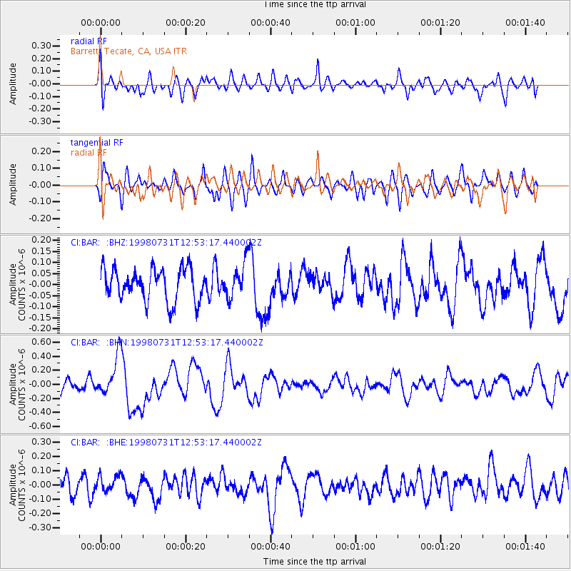
BAR Barrett, Tecate, CA, USA - Earthquake Result Viewer
*The percent match for this event was below the threshold and hence no stack was calculated.
| Earthquake location: |
Southeast Of Loyalty Islands |
| Earthquake latitude/longitude: |
-21.6/169.8 |
| Earthquake time(UTC): |
1998/07/31 (212) 12:40:59 GMT |
| Earthquake Depth: |
33 km |
| Earthquake Magnitude: |
5.9 MS, 5.4 MB, 6.1 UNKNOWN, 6.0 MW |
| Earthquake Catalog/Contributor: |
WHDF/NEIC |
|
| Network: |
CI Caltech Regional Seismic Network |
| Station: |
BAR Barrett, Tecate, CA, USA |
| Lat/Lon: |
32.68 N/116.67 W |
| Elevation: |
521 m |
|
| Distance: |
88.5 deg |
| Az: |
53.99 deg |
| Baz: |
243.195 deg |
| Ray Param: |
$rayparam |
*The percent match for this event was below the threshold and hence was not used in the summary stack. |
|
| Radial Match: |
60.465916 % |
| Radial Bump: |
400 |
| Transverse Match: |
60.952663 % |
| Transverse Bump: |
400 |
| SOD ConfigId: |
4480 |
| Insert Time: |
2010-02-26 00:14:27.717 +0000 |
| GWidth: |
2.5 |
| Max Bumps: |
400 |
| Tol: |
0.001 |
|
Signal To Noise
| Channel | StoN | STA | LTA |
| CI:BAR: :BHN:19980731T12:53:17.440002Z | 3.8758035 | 3.0294643E-7 | 7.816352E-8 |
| CI:BAR: :BHE:19980731T12:53:17.440002Z | 1.0701576 | 6.318473E-8 | 5.904245E-8 |
| CI:BAR: :BHZ:19980731T12:53:17.440002Z | 1.1440836 | 8.269189E-8 | 7.2277835E-8 |
| Arrivals |
| Ps | |
| PpPs | |
| PsPs/PpSs | |


