You are here: Home > Network List > US - United States National Seismic Network Stations List
> Station DGMT Dagmar, Montana, USA > Earthquake Result Viewer
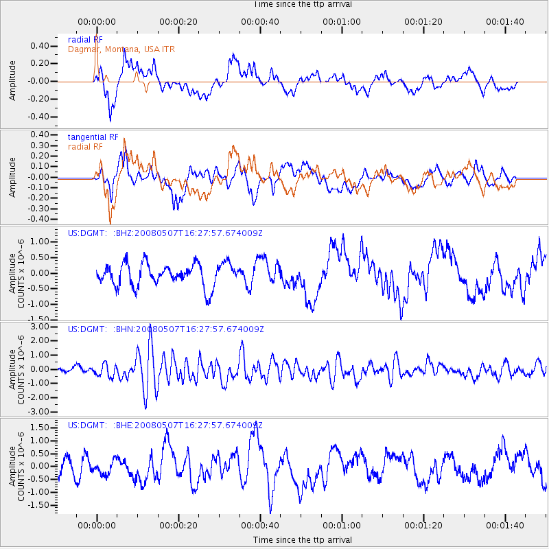
DGMT Dagmar, Montana, USA - Earthquake Result Viewer
*The percent match for this event was below the threshold and hence no stack was calculated.
| Earthquake location: |
Near East Coast Of Honshu, Japan |
| Earthquake latitude/longitude: |
36.2/141.8 |
| Earthquake time(UTC): |
2008/05/07 (128) 16:16:36 GMT |
| Earthquake Depth: |
23 km |
| Earthquake Magnitude: |
5.9 MB, 6.1 MW, 6.0 MW |
| Earthquake Catalog/Contributor: |
WHDF/NEIC |
|
| Network: |
US United States National Seismic Network |
| Station: |
DGMT Dagmar, Montana, USA |
| Lat/Lon: |
48.47 N/104.20 W |
| Elevation: |
0.0 m |
|
| Distance: |
77.4 deg |
| Az: |
38.525 deg |
| Baz: |
310.762 deg |
| Ray Param: |
$rayparam |
*The percent match for this event was below the threshold and hence was not used in the summary stack. |
|
| Radial Match: |
60.250504 % |
| Radial Bump: |
373 |
| Transverse Match: |
55.05229 % |
| Transverse Bump: |
384 |
| SOD ConfigId: |
2504 |
| Insert Time: |
2010-03-05 01:28:18.433 +0000 |
| GWidth: |
2.5 |
| Max Bumps: |
400 |
| Tol: |
0.001 |
|
Signal To Noise
| Channel | StoN | STA | LTA |
| US:DGMT: :BHN:20080507T16:27:57.674009Z | 2.7349913 | 4.2916193E-7 | 1.5691528E-7 |
| US:DGMT: :BHE:20080507T16:27:57.674009Z | 0.78504205 | 2.7554069E-7 | 3.5098844E-7 |
| US:DGMT: :BHZ:20080507T16:27:57.674009Z | 0.93947625 | 2.8375382E-7 | 3.0203407E-7 |
| Arrivals |
| Ps | |
| PpPs | |
| PsPs/PpSs | |


