You are here: Home > Network List > US - United States National Seismic Network Stations List
> Station DGMT Dagmar, Montana, USA > Earthquake Result Viewer
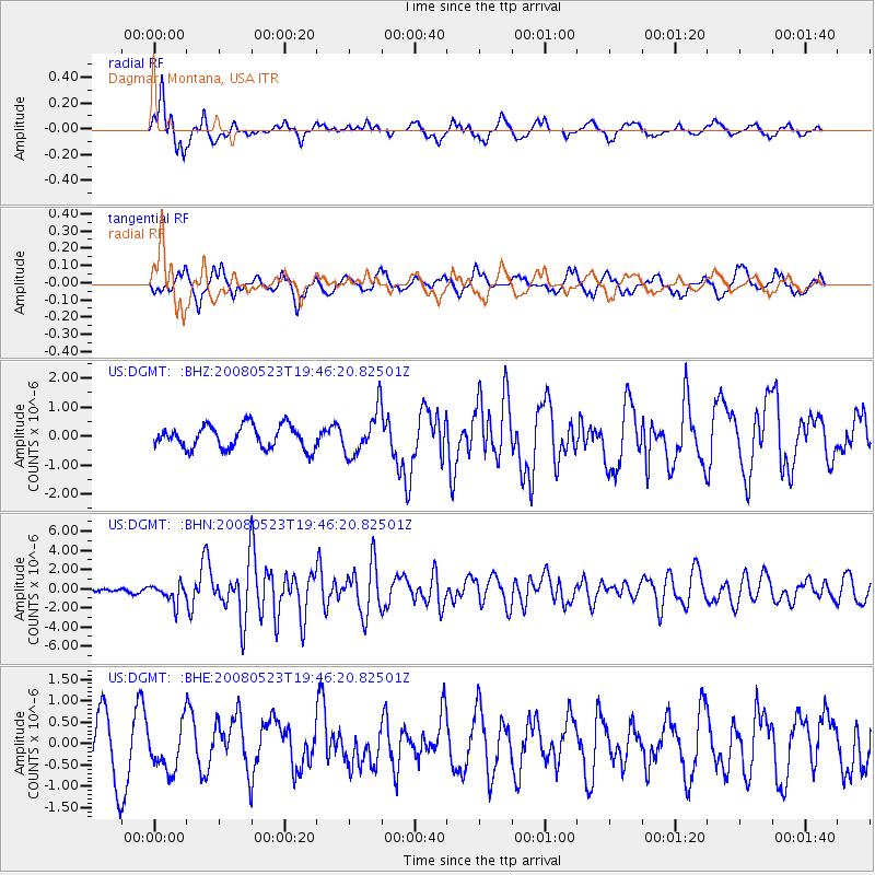
DGMT Dagmar, Montana, USA - Earthquake Result Viewer
*The percent match for this event was below the threshold and hence no stack was calculated.
| Earthquake location: |
Central Mid-Atlantic Ridge |
| Earthquake latitude/longitude: |
7.3/-34.9 |
| Earthquake time(UTC): |
2008/05/23 (144) 19:35:34 GMT |
| Earthquake Depth: |
9.0 km |
| Earthquake Magnitude: |
6.0 MB, 6.4 MS, 6.5 MW, 6.5 MW |
| Earthquake Catalog/Contributor: |
WHDF/NEIC |
|
| Network: |
US United States National Seismic Network |
| Station: |
DGMT Dagmar, Montana, USA |
| Lat/Lon: |
48.47 N/104.20 W |
| Elevation: |
0.0 m |
|
| Distance: |
70.9 deg |
| Az: |
318.782 deg |
| Baz: |
100.834 deg |
| Ray Param: |
$rayparam |
*The percent match for this event was below the threshold and hence was not used in the summary stack. |
|
| Radial Match: |
77.60945 % |
| Radial Bump: |
400 |
| Transverse Match: |
65.04278 % |
| Transverse Bump: |
400 |
| SOD ConfigId: |
2504 |
| Insert Time: |
2010-03-05 01:28:21.841 +0000 |
| GWidth: |
2.5 |
| Max Bumps: |
400 |
| Tol: |
0.001 |
|
Signal To Noise
| Channel | StoN | STA | LTA |
| US:DGMT: :BHN:20080523T19:46:20.82501Z | 3.9126832 | 1.000287E-6 | 2.5565245E-7 |
| US:DGMT: :BHE:20080523T19:46:20.82501Z | 0.9641259 | 5.280396E-7 | 5.476874E-7 |
| US:DGMT: :BHZ:20080523T19:46:20.82501Z | 1.9563774 | 7.749524E-7 | 3.96116E-7 |
| Arrivals |
| Ps | |
| PpPs | |
| PsPs/PpSs | |


