You are here: Home > Network List > AZ - ANZA Regional Network Stations List
> Station SMER AZ.SMER > Earthquake Result Viewer
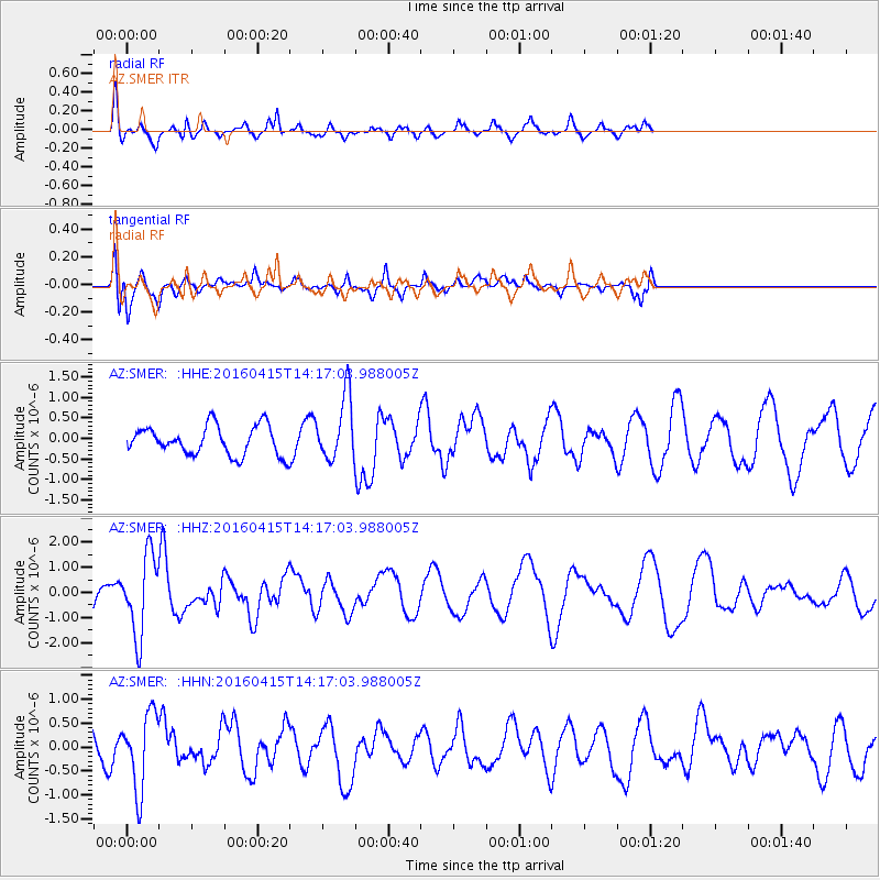
SMER AZ.SMER - Earthquake Result Viewer
*The percent match for this event was below the threshold and hence no stack was calculated.
| Earthquake location: |
Off Coast Of Chiapas, Mexico |
| Earthquake latitude/longitude: |
13.5/-92.2 |
| Earthquake time(UTC): |
2016/04/15 (106) 14:11:29 GMT |
| Earthquake Depth: |
48 km |
| Earthquake Magnitude: |
6.2 MWP |
| Earthquake Catalog/Contributor: |
NEIC PDE/NEIC COMCAT |
|
| Network: |
AZ ANZA Regional Network |
| Station: |
SMER AZ.SMER |
| Lat/Lon: |
33.46 N/117.17 W |
| Elevation: |
355 m |
|
| Distance: |
30.2 deg |
| Az: |
315.403 deg |
| Baz: |
125.21 deg |
| Ray Param: |
$rayparam |
*The percent match for this event was below the threshold and hence was not used in the summary stack. |
|
| Radial Match: |
57.712856 % |
| Radial Bump: |
281 |
| Transverse Match: |
67.30179 % |
| Transverse Bump: |
400 |
| SOD ConfigId: |
7422571 |
| Insert Time: |
2019-04-22 06:56:26.121 +0000 |
| GWidth: |
2.5 |
| Max Bumps: |
400 |
| Tol: |
0.001 |
|
Signal To Noise
| Channel | StoN | STA | LTA |
| AZ:SMER: :HHZ:20160415T14:17:03.988005Z | 2.5556326 | 1.5783686E-6 | 6.176039E-7 |
| AZ:SMER: :HHN:20160415T14:17:03.988005Z | 1.7678307 | 7.8758706E-7 | 4.4551044E-7 |
| AZ:SMER: :HHE:20160415T14:17:03.988005Z | 2.61249 | 9.578816E-7 | 3.666547E-7 |
| Arrivals |
| Ps | |
| PpPs | |
| PsPs/PpSs | |


